
NE 11 Bus Route Map
View the NE 11 route map and see all NE 11 stops along the route. The map of NE 11 shows where the bus travels and the location of each stop, making it easy to understand the entire route at a glance.
Explore DVG AG routes on the map and see where DVG AG bus services operate. Use the NE 11 map to find bus stops and see how the NE 11 connects different areas along its trip.
All NE 11 stops on the map are displayed in route order, helping you follow the NE 11 bus from the first stop to the last.
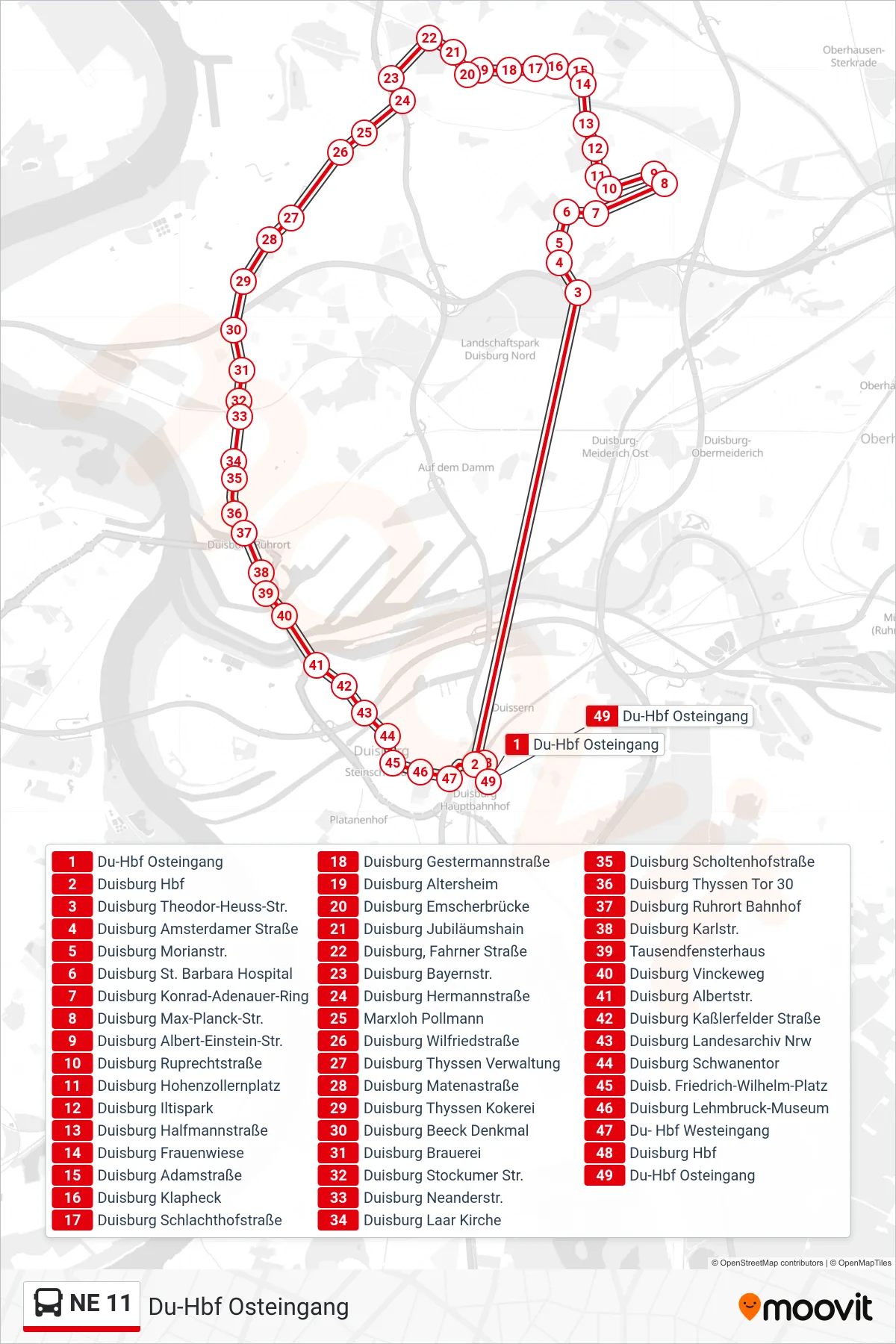
Stops list (NE 11 - Du-Hbf Osteingang)
- Du-Hbf Osteingang
- Duisburg Hbf
- Duisburg Theodor-Heuss-Str.
- Duisburg Amsterdamer Straße
- Duisburg Morianstr.
- Duisburg St. Barbara Hospital
- Duisburg Konrad-Adenauer-Ring
- Duisburg Max-Planck-Str.
- Duisburg Albert-Einstein-Str.
- Duisburg Ruprechtstraße
- Duisburg Hohenzollernplatz
- Duisburg Iltispark
- Duisburg Halfmannstraße
- Duisburg Frauenwiese
- Duisburg Adamstraße
- Duisburg Klapheck
- Duisburg Schlachthofstraße
- Duisburg Gestermannstraße
- Duisburg Altersheim
- Duisburg Emscherbrücke
- Duisburg Jubiläumshain
- Duisburg, Fahrner Straße
- Duisburg Bayernstr.
- Duisburg Hermannstraße
- Marxloh Pollmann
- Duisburg Wilfriedstraße
- Duisburg Thyssen Verwaltung
- Duisburg Matenastraße
- Duisburg Thyssen Kokerei
- Duisburg Beeck Denkmal
- Duisburg Brauerei
- Duisburg Stockumer Str.
- Duisburg Neanderstr.
- Duisburg Laar Kirche
- Duisburg Scholtenhofstraße
- Duisburg Thyssen Tor 30
- Duisburg Ruhrort Bahnhof
- Duisburg Karlstr.
- Tausendfensterhaus
- Duisburg Vinckeweg
- Duisburg Albertstr.
- Duisburg Kaßlerfelder Straße
- Duisburg Landesarchiv Nrw
- Duisburg Schwanentor
- Duisb. Friedrich-Wilhelm-Platz
- Duisburg Lehmbruck-Museum
- Du- Hbf Westeingang
- Duisburg Hbf
- Du-Hbf Osteingang