
NE 2 Bus Route Map
View the NE 2 route map and see all NE 2 stops along the route. The map of NE 2 shows where the bus travels and the location of each stop, making it easy to understand the entire route at a glance.
Explore DVG AG routes on the map and see where DVG AG bus services operate. Use the NE 2 map to find bus stops and see how the NE 2 connects different areas along its trip.
All NE 2 stops on the map are displayed in route order, helping you follow the NE 2 bus from the first stop to the last.
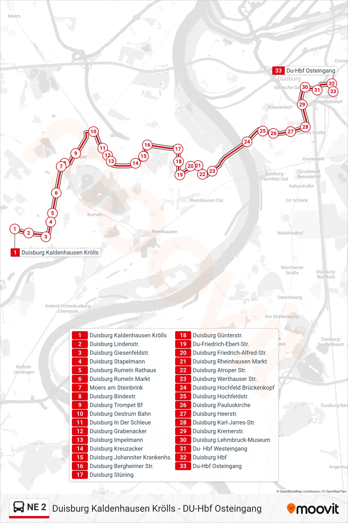
Stops list (NE 2 - Du-Hbf Osteingang)
- Duisburg Kaldenhausen Krölls
- Duisburg Lindenstr.
- Duisburg Giesenfeldstr.
- Duisburg Stapelmann
- Duisburg Rumeln Rathaus
- Duisburg Rumeln Markt
- Moers am Steinbrink
- Duisburg Bindestr.
- Duisburg Trompet Bf
- Duisburg Oestrum Bahn
- Duisburg In Der Schleue
- Duisburg Grabenacker
- Duisburg Impelmann
- Duisburg Kreuzacker
- Duisburg Johanniter Krankenhs.
- Duisburg Bergheimer Str.
- Duisburg Stüning
- Duisburg Günterstr.
- Du-Friedrich-Ebert-Str.
- Duisburg Friedrich-Alfred-Str.
- Duisburg Rheinhausen Markt
- Duisburg Atroper Str.
- Duisburg Werthauser Str.
- Duisburg Hochfeld Brückenkopf
- Duisburg Hochfeldstr.
- Duisburg Pauluskirche
- Duisburg Heerstr.
- Duisburg Karl-Jarres-Str.
- Duisburg Kremerstr.
- Duisburg Lehmbruck-Museum
- Du- Hbf Westeingang
- Duisburg Hbf
- Du-Hbf Osteingang