
NE 3 Bus Route Map
View the NE 3 route map and see all NE 3 stops along the route. The map of NE 3 shows where the bus travels and the location of each stop, making it easy to understand the entire route at a glance.
Explore Ruhrbahn Mülheim routes on the map and see where Ruhrbahn Mülheim bus services operate. Use the NE 3 map to find bus stops and see how the NE 3 connects different areas along its trip.
All NE 3 stops on the map are displayed in route order, helping you follow the NE 3 bus from the first stop to the last.
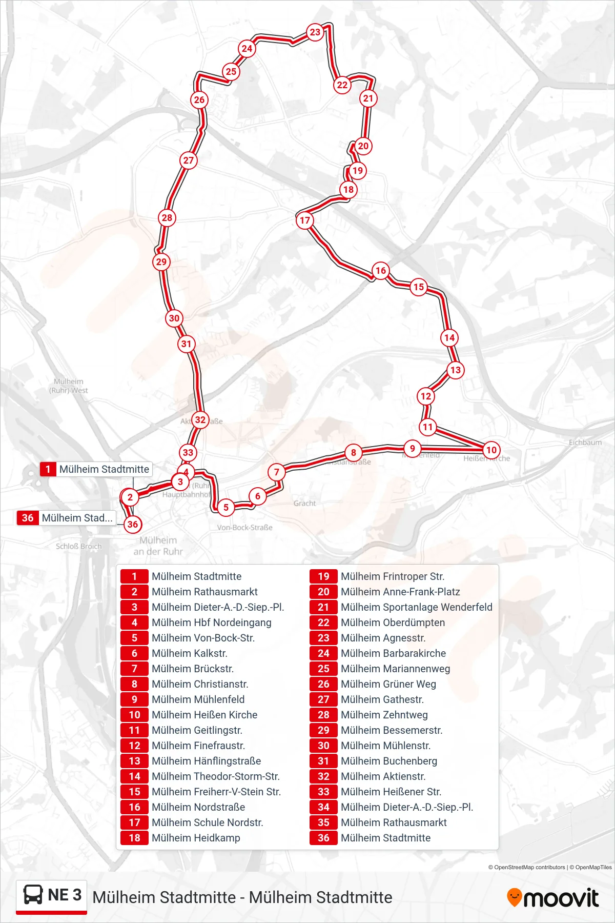
Stops list (NE 3 - Mülheim Stadtmitte)
- Mülheim Stadtmitte
- Mülheim Rathausmarkt
- Mülheim Dieter-A.-D.-Siep.-Pl.
- Mülheim Hbf Nordeingang
- Mülheim Von-Bock-Str.
- Mülheim Kalkstr.
- Mülheim Brückstr.
- Mülheim Christianstr.
- Mülheim Mühlenfeld
- Mülheim Heißen Kirche
- Mülheim Geitlingstr.
- Mülheim Finefraustr.
- Mülheim Hänflingstraße
- Mülheim Theodor-Storm-Str.
- Mülheim Freiherr-V-Stein Str.
- Mülheim Nordstraße
- Mülheim Schule Nordstr.
- Mülheim Heidkamp
- Mülheim Frintroper Str.
- Mülheim Anne-Frank-Platz
- Mülheim Sportanlage Wenderfeld
- Mülheim Oberdümpten
- Mülheim Agnesstr.
- Mülheim Barbarakirche
- Mülheim Mariannenweg
- Mülheim Grüner Weg
- Mülheim Gathestr.
- Mülheim Zehntweg
- Mülheim Bessemerstr.
- Mülheim Mühlenstr.
- Mülheim Buchenberg
- Mülheim Aktienstr.
- Mülheim Heißener Str.
- Mülheim Dieter-A.-D.-Siep.-Pl.
- Mülheim Rathausmarkt
- Mülheim Stadtmitte