
NE 4 Bus Route Map
View the NE 4 route map and see all NE 4 stops along the route. The map of NE 4 shows where the bus travels and the location of each stop, making it easy to understand the entire route at a glance.
Explore DVG AG routes on the map and see where DVG AG bus services operate. Use the NE 4 map to find bus stops and see how the NE 4 connects different areas along its trip.
All NE 4 stops on the map are displayed in route order, helping you follow the NE 4 bus from the first stop to the last.
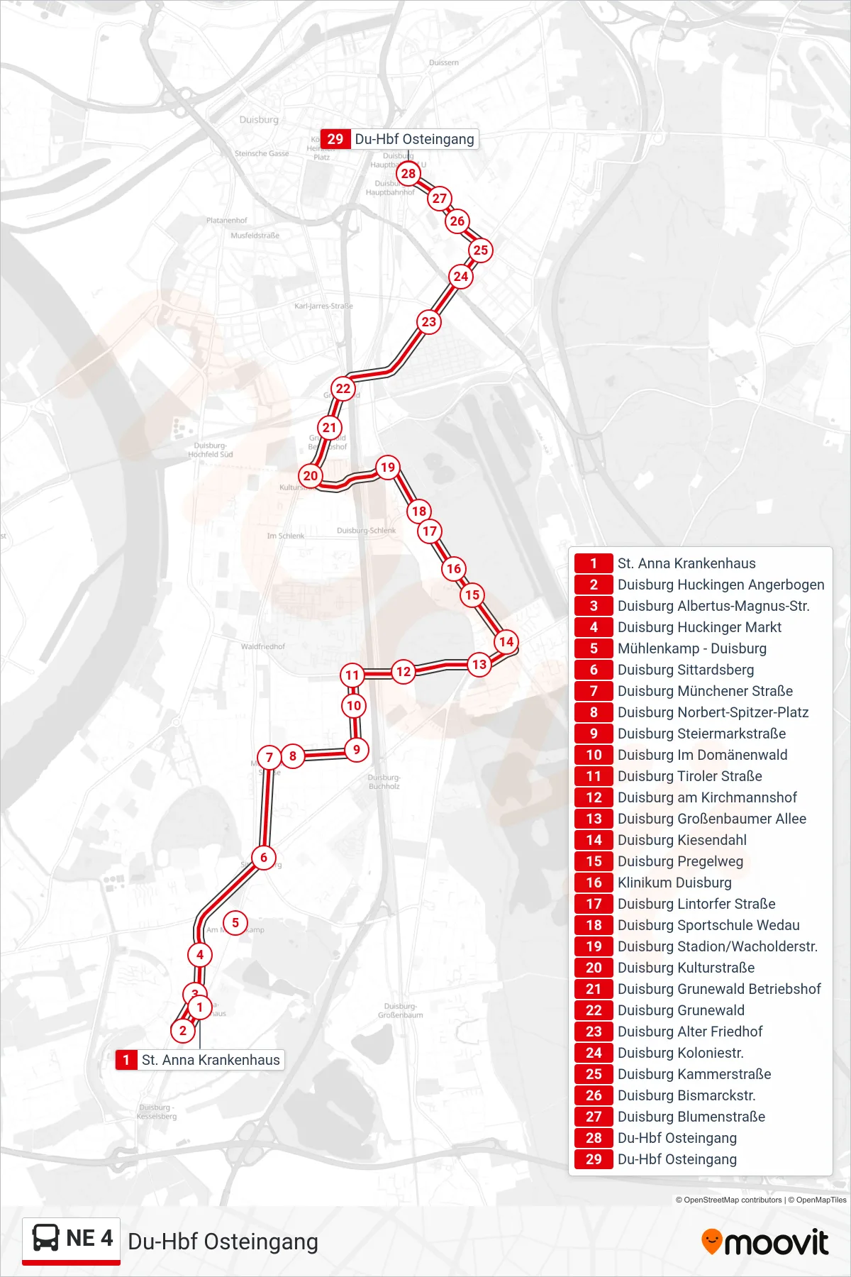
Stops list (NE 4 - Du-Hbf Osteingang)
- St. Anna Krankenhaus
- Duisburg Huckingen Angerbogen
- Duisburg Albertus-Magnus-Str.
- Duisburg Huckinger Markt
- Mühlenkamp - Duisburg
- Duisburg Sittardsberg
- Duisburg Münchener Straße
- Duisburg Norbert-Spitzer-Platz
- Duisburg Steiermarkstraße
- Duisburg Im Domänenwald
- Duisburg Tiroler Straße
- Duisburg am Kirchmannshof
- Duisburg Großenbaumer Allee
- Duisburg Kiesendahl
- Duisburg Pregelweg
- Klinikum Duisburg
- Duisburg Lintorfer Straße
- Duisburg Sportschule Wedau
- Duisburg Stadion/Wacholderstr.
- Duisburg Kulturstraße
- Duisburg Grunewald Betriebshof
- Duisburg Grunewald
- Duisburg Alter Friedhof
- Duisburg Koloniestr.
- Duisburg Kammerstraße
- Duisburg Bismarckstr.
- Duisburg Blumenstraße
- Du-Hbf Osteingang
- Du-Hbf Osteingang