
NE 5 Bus Route Map
View the NE 5 route map and see all NE 5 stops along the route. The map of NE 5 shows where the bus travels and the location of each stop, making it easy to understand the entire route at a glance.
Explore Ruhrbahn Mülheim routes on the map and see where Ruhrbahn Mülheim bus services operate. Use the NE 5 map to find bus stops and see how the NE 5 connects different areas along its trip.
All NE 5 stops on the map are displayed in route order, helping you follow the NE 5 bus from the first stop to the last.
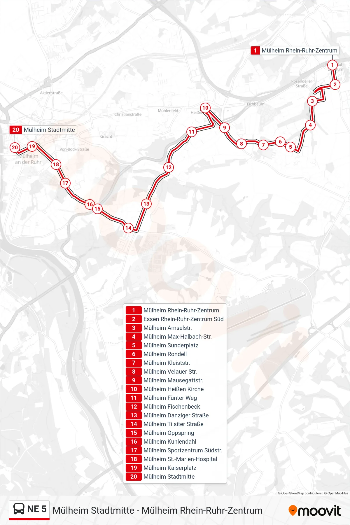
Stops list (NE 5 - Mülheim Stadtmitte)
- Mülheim Rhein-Ruhr-Zentrum
- Essen Rhein-Ruhr-Zentrum Süd
- Mülheim Amselstr.
- Mülheim Max-Halbach-Str.
- Mülheim Sunderplatz
- Mülheim Rondell
- Mülheim Kleiststr.
- Mülheim Velauer Str.
- Mülheim Mausegattstr.
- Mülheim Heißen Kirche
- Mülheim Fünter Weg
- Mülheim Fischenbeck
- Mülheim Danziger Straße
- Mülheim Tilsiter Straße
- Mülheim Oppspring
- Mülheim Kuhlendahl
- Mülheim Sportzentrum Südstr.
- Mülheim St.-Marien-Hospital
- Mülheim Kaiserplatz
- Mülheim Stadtmitte