
NE 7 Bus Route Map
View the NE 7 route map and see all NE 7 stops along the route. The map of NE 7 shows where the bus travels and the location of each stop, making it easy to understand the entire route at a glance.
Explore WSW routes on the map and see where WSW bus services operate. Use the NE 7 map to find bus stops and see how the NE 7 connects different areas along its trip.
All NE 7 stops on the map are displayed in route order, helping you follow the NE 7 bus from the first stop to the last.
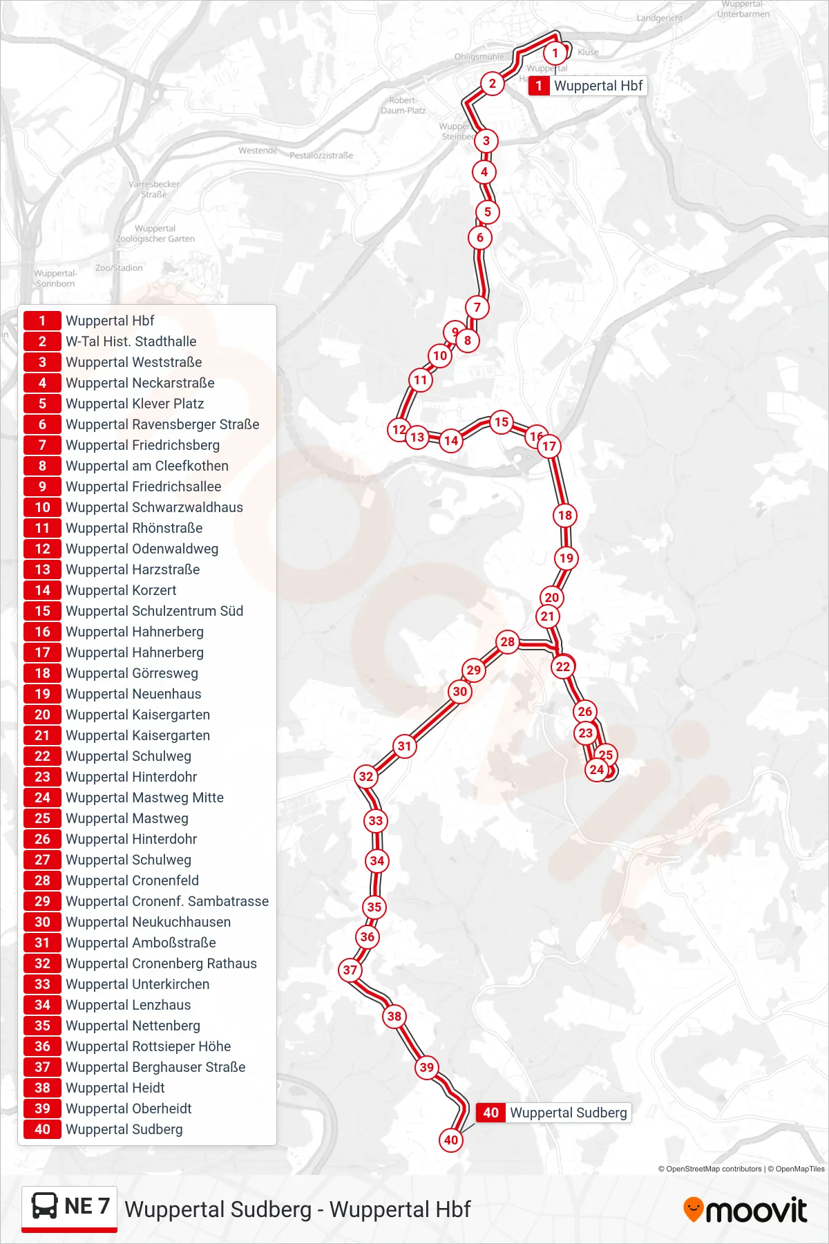
Stops list (NE 7 - Wuppertal Sudberg)
- Wuppertal Hbf
- W-Tal Hist. Stadthalle
- Wuppertal Weststraße
- Wuppertal Neckarstraße
- Wuppertal Klever Platz
- Wuppertal Ravensberger Straße
- Wuppertal Friedrichsberg
- Wuppertal am Cleefkothen
- Wuppertal Friedrichsallee
- Wuppertal Schwarzwaldhaus
- Wuppertal Rhönstraße
- Wuppertal Odenwaldweg
- Wuppertal Harzstraße
- Wuppertal Korzert
- Wuppertal Schulzentrum Süd
- Wuppertal Hahnerberg
- Wuppertal Hahnerberg
- Wuppertal Görresweg
- Wuppertal Neuenhaus
- Wuppertal Kaisergarten
- Wuppertal Kaisergarten
- Wuppertal Schulweg
- Wuppertal Hinterdohr
- Wuppertal Mastweg Mitte
- Wuppertal Mastweg
- Wuppertal Hinterdohr
- Wuppertal Schulweg
- Wuppertal Cronenfeld
- Wuppertal Cronenf. Sambatrasse
- Wuppertal Neukuchhausen
- Wuppertal Amboßstraße
- Wuppertal Cronenberg Rathaus
- Wuppertal Unterkirchen
- Wuppertal Lenzhaus
- Wuppertal Nettenberg
- Wuppertal Rottsieper Höhe
- Wuppertal Berghauser Straße
- Wuppertal Heidt
- Wuppertal Oberheidt
- Wuppertal Sudberg