
NU Bus Route Map
View the NU route map and see all NU stops along the route. The map of NU shows where the bus travels and the location of each stop, making it easy to understand the entire route at a glance.
Explore Chapel Hill Transit routes on the map and see where Chapel Hill Transit bus services operate. Use the NU map to find bus stops and see how the NU connects different areas along its trip.
All NU stops on the map are displayed in route order, helping you follow the NU bus from the first stop to the last.
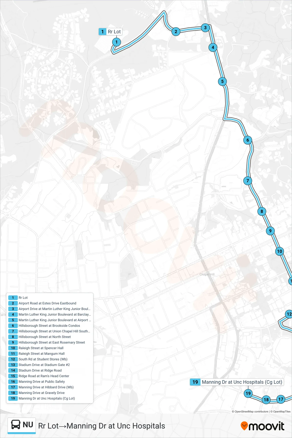
Stops list (NU - Rr Lot→Manning Dr at Unc Hospitals)
- Rr Lot
- Airport Road at Estes Drive Eastbound
- Airport Drive at Martin Luther King Junior Boulevard Eastbound
- Martin Luther King Junior Boulevard at Barclay Road
- Martin Luther King Junior Boulevard at Airport Gardens Apartments
- Hillsborough Street at Brookside Condos
- Hillsborough Street at Union Chapel Hill Southbound
- Hillsborough Street at North Street
- Hillsborough Street at East Rosemary Street
- Raleigh Street at Spencer Hall
- Raleigh Street at Mangum Hall
- South Rd at Student Stores (Wb)
- Stadium Drive at Stadium Gate #2
- Stadium Drive at Ridge Road
- Ridge Road at Ram's Head Center
- Manning Drive at Public Safety
- Manning Drive at Hibbard Drive (Wb)
- Manning Drive at Gravely Drive
- Manning Dr at Unc Hospitals (Cg Lot)