
OCH Bus Route Map
View the OCH route map and see all OCH stops along the route. The map of OCH shows where the bus travels and the location of each stop, making it easy to understand the entire route at a glance.
Explore Orange County Public Transportation routes on the map and see where Orange County Public Transportation bus services operate. Use the OCH map to find bus stops and see how the OCH connects different areas along its trip.
All OCH stops on the map are displayed in route order, helping you follow the OCH bus from the first stop to the last.
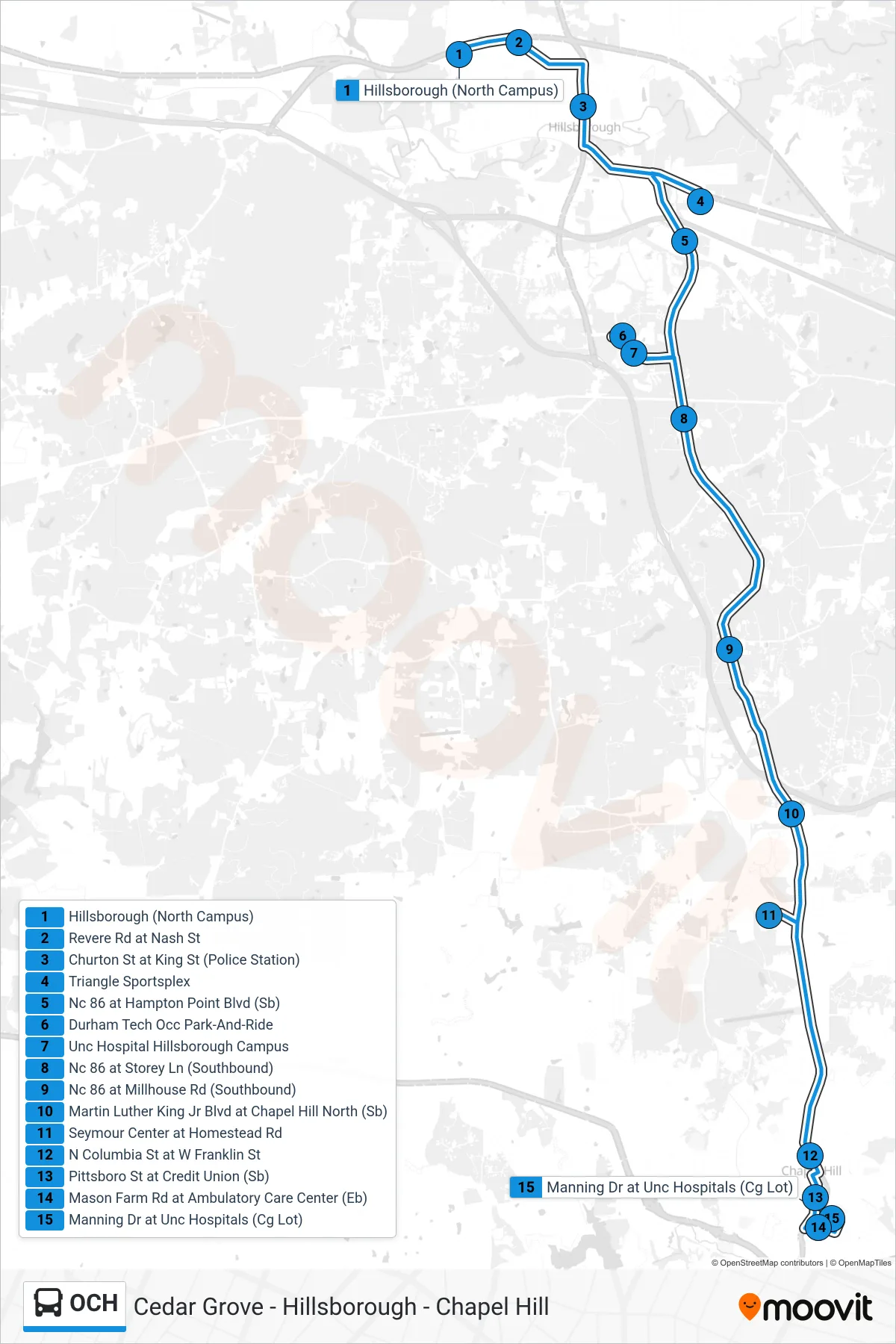
Stops list (OCH - Cedar Grove - Hillsborough - Chapel Hill)
- Hillsborough (North Campus)
- Revere Rd at Nash St
- Churton St at King St (Police Station)
- Triangle Sportsplex
- Nc 86 at Hampton Point Blvd (Sb)
- Durham Tech Occ Park-And-Ride
- Unc Hospital Hillsborough Campus
- Nc 86 at Storey Ln (Southbound)
- Nc 86 at Millhouse Rd (Southbound)
- Martin Luther King Jr Blvd at Chapel Hill North (Sb)
- Seymour Center at Homestead Rd
- N Columbia St at W Franklin St
- Pittsboro St at Credit Union (Sb)
- Mason Farm Rd at Ambulatory Care Center (Eb)
- Manning Dr at Unc Hospitals (Cg Lot)