
ORANGE Metro Route Map
View the ORANGE route map and see all ORANGE stops along the route. The map of ORANGE shows where the metro travels and the location of each stop, making it easy to understand the entire route at a glance.
Explore WMATA routes on the map and see where WMATA metro services operate. Use the ORANGE map to find metro stations and see how the ORANGE connects different areas along its trip.
All ORANGE stops on the map are displayed in route order, helping you follow the ORANGE metro from the first station to the last.
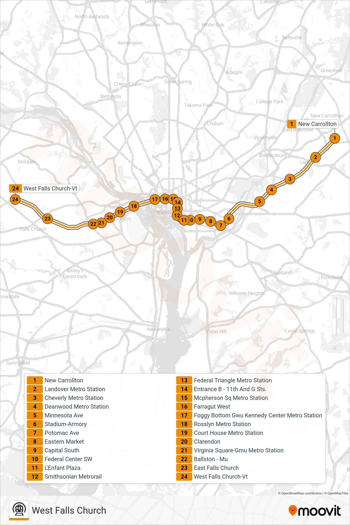
Stops list (ORANGE - West Falls Church)
- New Carrollton
- Landover Metro Station
- Cheverly Metro Station
- Deanwood Metro Station
- Minnesota Ave
- Stadium-Armory
- Potomac Ave
- Eastern Market
- Capital South
- Federal Center SW
- L'Enfant Plaza
- Smithsonian Metrorail
- Federal Triangle Metro Station
- Entrance B - 11th And G Sts.
- Mcpherson Sq Metro Station
- Farragut West
- Foggy Bottom Gwu Kennedy Center Metro Station
- Rosslyn Metro Station
- Court House Metro Station
- Clarendon
- Virginia Square-Gmu Metro Station
- Ballston - Mu
- East Falls Church
- West Falls Church-Vt