
P56 Bus Route Map
View the P56 route map and see all P56 stops along the route. The map of P56 shows where the bus travels and the location of each stop, making it easy to understand the entire route at a glance.
Explore Prince Georges County's TheBus routes on the map and see where Prince Georges County's TheBus bus services operate. Use the P56 map to find bus stops and see how the P56 connects different areas along its trip.
All P56 stops on the map are displayed in route order, helping you follow the P56 bus from the first stop to the last.
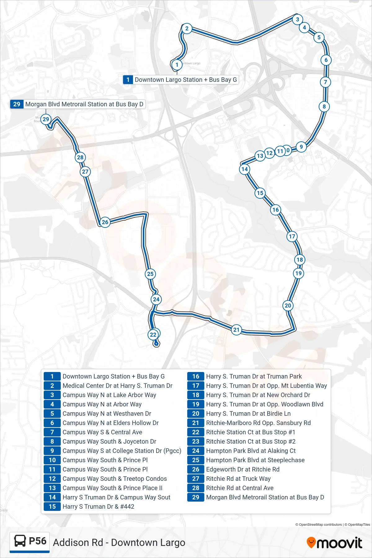
Stops list (P56 - Morgan Blvd Station)
- Downtown Largo Station + Bus Bay G
- Medical Center Dr at Harry S. Truman Dr
- Campus Way N at Lake Arbor Way
- Campus Way N at Arbor Way
- Campus Way N at Westhaven Dr
- Campus Way N at Elders Hollow Dr
- Campus Way S & Central Ave
- Campus Way South & Joyceton Dr
- Campus Way S at College Station Dr (Pgcc)
- Campus Way South & Prince Pl
- Campus Way South & Prince Pl
- Campus Way South & Treetop Condos
- Campus Way South & Prince Place II
- Harry S Truman Dr & Campus Way Sout
- Harry S Truman Dr & #442
- Harry S. Truman Dr at Truman Park
- Harry S. Truman Dr at Opp. Mt Lubentia Way
- Harry S. Truman Dr at New Orchard Dr
- Harry S. Truman Dr at Opp. Woodlawn Blvd
- Harry S. Truman Dr at Birdie Ln
- Ritchie-Marlboro Rd Opp. Sansbury Rd
- Ritchie Station Ct at Bus Stop #1
- Ritchie Station Ct at Bus Stop #2
- Hampton Park Blvd at Alaking Ct
- Hampton Park Blvd at Steeplechase
- Edgeworth Dr at Ritchie Rd
- Ritchie Rd at Truck Way
- Ritchie Rd at Central Ave
- Morgan Blvd Metrorail Station at Bus Bay D