
P90 Bus Route Map
View the P90 route map and see all P90 stops along the route. The map of P90 shows where the bus travels and the location of each stop, making it easy to understand the entire route at a glance.
Explore WMATA routes on the map and see where WMATA bus services operate. Use the P90 map to find bus stops and see how the P90 connects different areas along its trip.
All P90 stops on the map are displayed in route order, helping you follow the P90 bus from the first stop to the last.
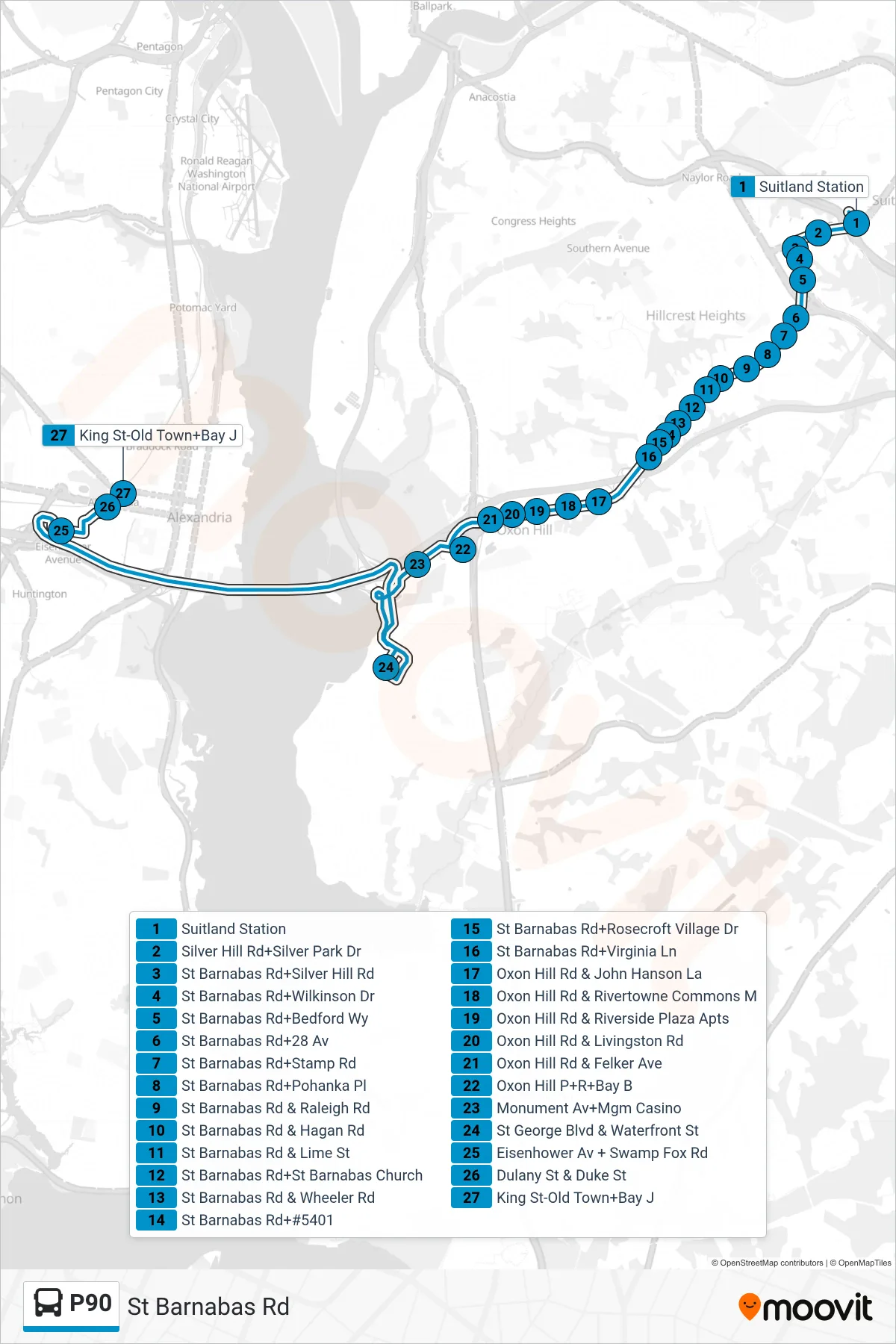
Stops list (P90 - West To King St-Old Town)
- Suitland Station
- Silver Hill Rd+Silver Park Dr
- St Barnabas Rd+Silver Hill Rd
- St Barnabas Rd+Wilkinson Dr
- St Barnabas Rd+Bedford Wy
- St Barnabas Rd+28 Av
- St Barnabas Rd+Stamp Rd
- St Barnabas Rd+Pohanka Pl
- St Barnabas Rd & Raleigh Rd
- St Barnabas Rd & Hagan Rd
- St Barnabas Rd & Lime St
- St Barnabas Rd+St Barnabas Church
- St Barnabas Rd & Wheeler Rd
- St Barnabas Rd+#5401
- St Barnabas Rd+Rosecroft Village Dr
- St Barnabas Rd+Virginia Ln
- Oxon Hill Rd & John Hanson La
- Oxon Hill Rd & Rivertowne Commons M
- Oxon Hill Rd & Riverside Plaza Apts
- Oxon Hill Rd & Livingston Rd
- Oxon Hill Rd & Felker Ave
- Oxon Hill P+R+Bay B
- Monument Av+Mgm Casino
- St George Blvd & Waterfront St
- Eisenhower Av + Swamp Fox Rd
- Dulany St & Duke St
- King St-Old Town+Bay J