
POHJAVAARA IP Bus Route Map
View the POHJAVAARA IP route map and see all POHJAVAARA IP stops along the route. The map of POHJAVAARA IP shows where the bus travels and the location of each stop, making it easy to understand the entire route at a glance.
Explore Savo-Karjala Line Ltd routes on the map and see where Savo-Karjala Line Ltd bus services operate. Use the POHJAVAARA IP map to find bus stops and see how the POHJAVAARA IP connects different areas along its trip.
All POHJAVAARA IP stops on the map are displayed in route order, helping you follow the POHJAVAARA IP bus from the first stop to the last.
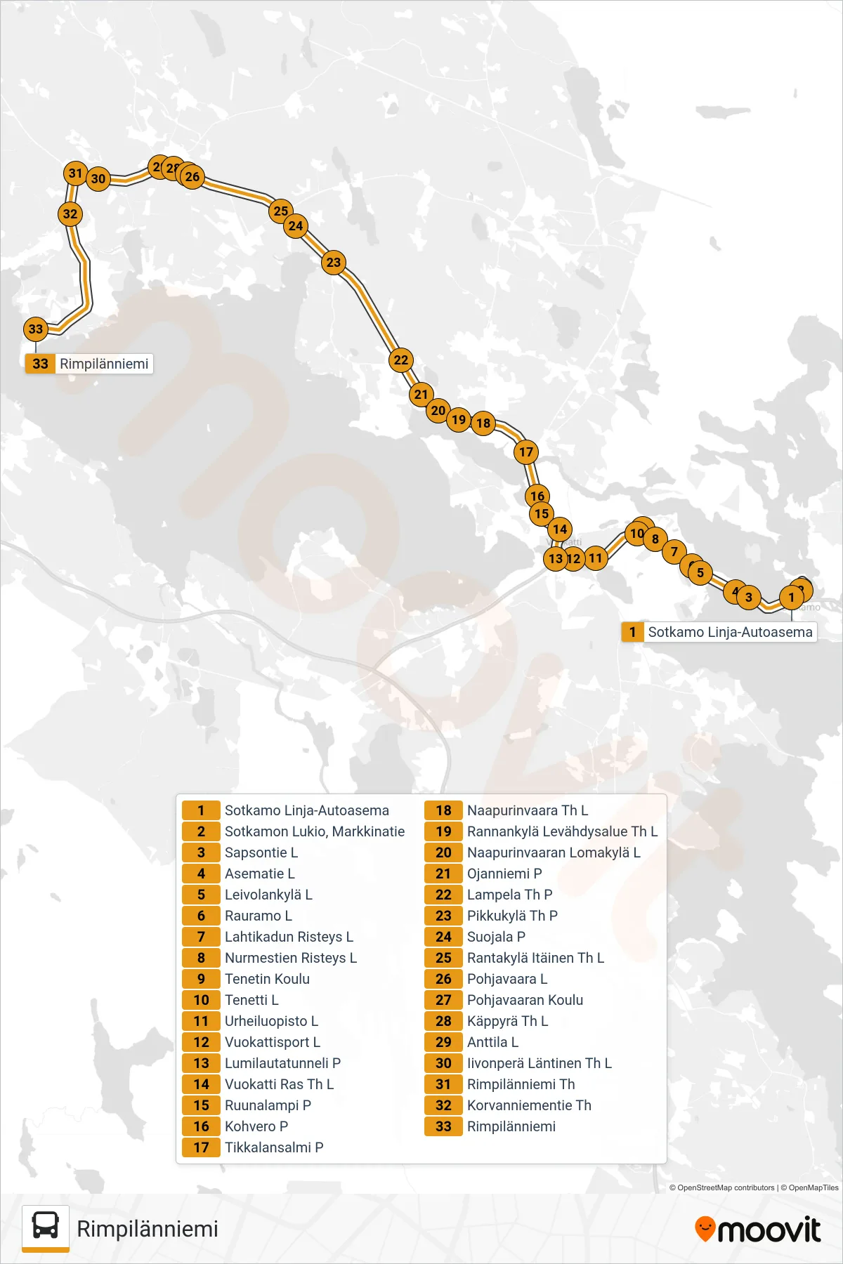
Stops list (POHJAVAARA IP - Rimpilänniemi)
- Sotkamo Bus Station
- Sotkamo High School, Market Road
- Sapsontie W
- Asematie W
- Leivolankyla W
- Rauramo West
- Lahtikatu Intersection W
- Nurmestie Intersection West
- Tenetti School
- Tenetti W
- Sports Institute E
- Vuokattisport West
- Snowboard Tunnel North
- Vuokatti Junction W
- Ruunalampi N
- Kohvero N
- Tikkalansalmi North
- Naapurinvaara Junction West
- Rannankylä Rest Area Junction West
- Naapurinvaara Holiday Village W
- Ojanniemi North
- Lampela Junction N
- Small Village Junction N
- Suojala North
- Rantakylä Eastern Junction W
- Pohjavaara West
- Pohjovaara School
- Käppyrä Junction West
- Anttila West
- Iivonperä Western Junction West
- Rimpilänniemi Junction
- Korvanniemi Road Crossroads
- Rimpilänniemi