
PPB Tram Route Map
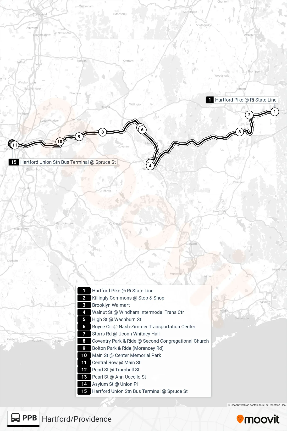
View the PPB route map and see all PPB stops along the route. The map of PPB shows where the tram travels and the location of each stop, making it easy to understand the entire route at a glance.
Explore routes on the map and see where tram services operate. Use the PPB map to find tram stations and see how the PPB connects different areas along its trip.
All PPB stops on the map are displayed in route order, helping you follow the PPB tram from the first station to the last.
Stops list (PPB - Ppb - Hartford)
- Hartford Pike @ Ri State Line
- Killingly Commons @ Stop & Shop
- Brooklyn Walmart
- Walnut St @ Windham Intermodal Trans Ctr
- High St @ Washburn St
- Royce Cir @ Nash-Zimmer Transportation Center
- Storrs Rd @ Uconn Whitney Hall
- Coventry Park & Ride @ Second Congregational Church
- Bolton Park & Ride (Morancey Rd)
- Main St @ Center Memorial Park
- Central Row @ Main St
- Pearl St @ Trumbull St
- Pearl St @ Ann Uccello St
- Asylum St @ Union Pl
- Hartford Union Stn Bus Terminal @ Spruce St