
PURPLE Bus Route Map
View the PURPLE route map and see all PURPLE stops along the route. The map of PURPLE shows where the bus travels and the location of each stop, making it easy to understand the entire route at a glance.
Explore STAR Transit routes on the map and see where STAR Transit bus services operate. Use the PURPLE map to find bus stops and see how the PURPLE connects different areas along its trip.
All PURPLE stops on the map are displayed in route order, helping you follow the PURPLE bus from the first stop to the last.
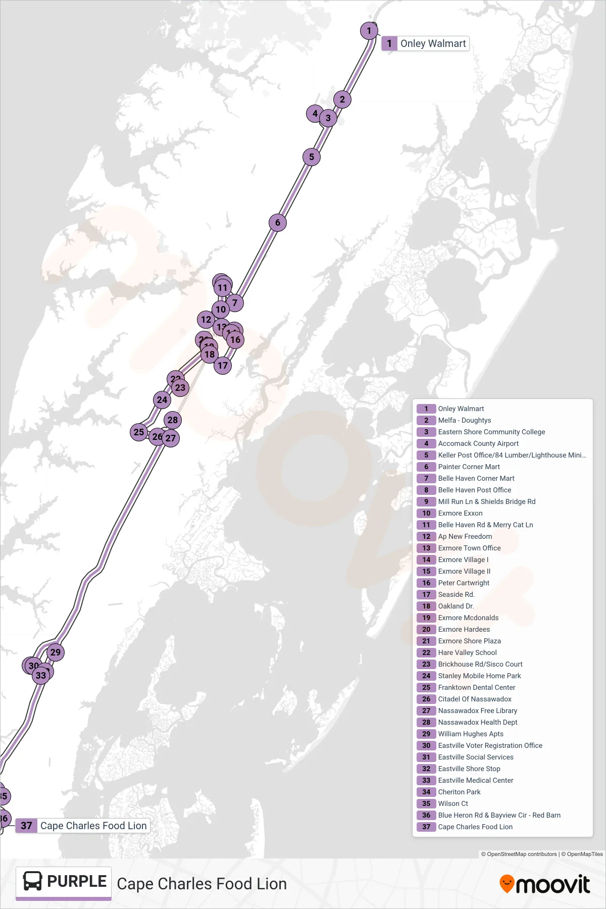
Stops list (PURPLE - Cape Charles Food Lion)
- Onley Walmart
- Melfa - Doughtys
- Eastern Shore Community College
- Accomack County Airport
- Keller Post Office/84 Lumber/Lighthouse Ministries
- Painter Corner Mart
- Belle Haven Corner Mart
- Belle Haven Post Office
- Mill Run Ln & Shields Bridge Rd
- Exmore Exxon
- Belle Haven Rd & Merry Cat Ln
- Ap New Freedom
- Exmore Town Office
- Exmore Village I
- Exmore Village II
- Peter Cartwright
- Seaside Rd.
- Oakland Dr.
- Exmore Mcdonalds
- Exmore Hardees
- Exmore Shore Plaza
- Hare Valley School
- Brickhouse Rd/Sisco Court
- Stanley Mobile Home Park
- Franktown Dental Center
- Citadel Of Nassawadox
- Nassawadox Free Library
- Nassawadox Health Dept
- William Hughes Apts
- Eastville Voter Registration Office
- Eastville Social Services
- Eastville Shore Stop
- Eastville Medical Center
- Cheriton Park
- Wilson Ct
- Blue Heron Rd & Bayview Cir - Red Barn
- Cape Charles Food Lion