
QX Bus Route Map
View the QX route map and see all QX stops along the route. The map of QX shows where the bus travels and the location of each stop, making it easy to understand the entire route at a glance.
Explore Rhode Island Public Transit Authority routes on the map and see where Rhode Island Public Transit Authority bus services operate. Use the QX map to find bus stops and see how the QX connects different areas along its trip.
All QX stops on the map are displayed in route order, helping you follow the QX bus from the first stop to the last.
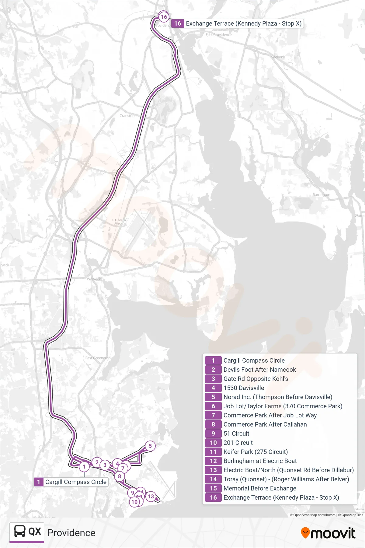
Stops list (QX - Providence)
- Cargill Compass Circle
- Devils Foot After Namcook
- Gate Rd Opposite Kohl's
- 1530 Davisville
- Norad Inc. (Thompson Before Davisville)
- Job Lot/Taylor Farms (370 Commerce Park)
- Commerce Park After Job Lot Way
- Commerce Park After Callahan
- 51 Circuit
- 201 Circuit
- Keifer Park (275 Circuit)
- Burlingham at Electric Boat
- Electric Boat/North (Quonset Rd Before Dillabur)
- Toray (Quonset) - (Roger Williams After Belver)
- Memorial Before Exchange
- Exchange Terrace (Kennedy Plaza - Stop X)