
R Bus Route Map
View the R route map and see all R stops along the route. The map of R shows where the bus travels and the location of each stop, making it easy to understand the entire route at a glance.
Explore Rhode Island Public Transit Authority routes on the map and see where Rhode Island Public Transit Authority bus services operate. Use the R map to find bus stops and see how the R connects different areas along its trip.
All R stops on the map are displayed in route order, helping you follow the R bus from the first stop to the last.
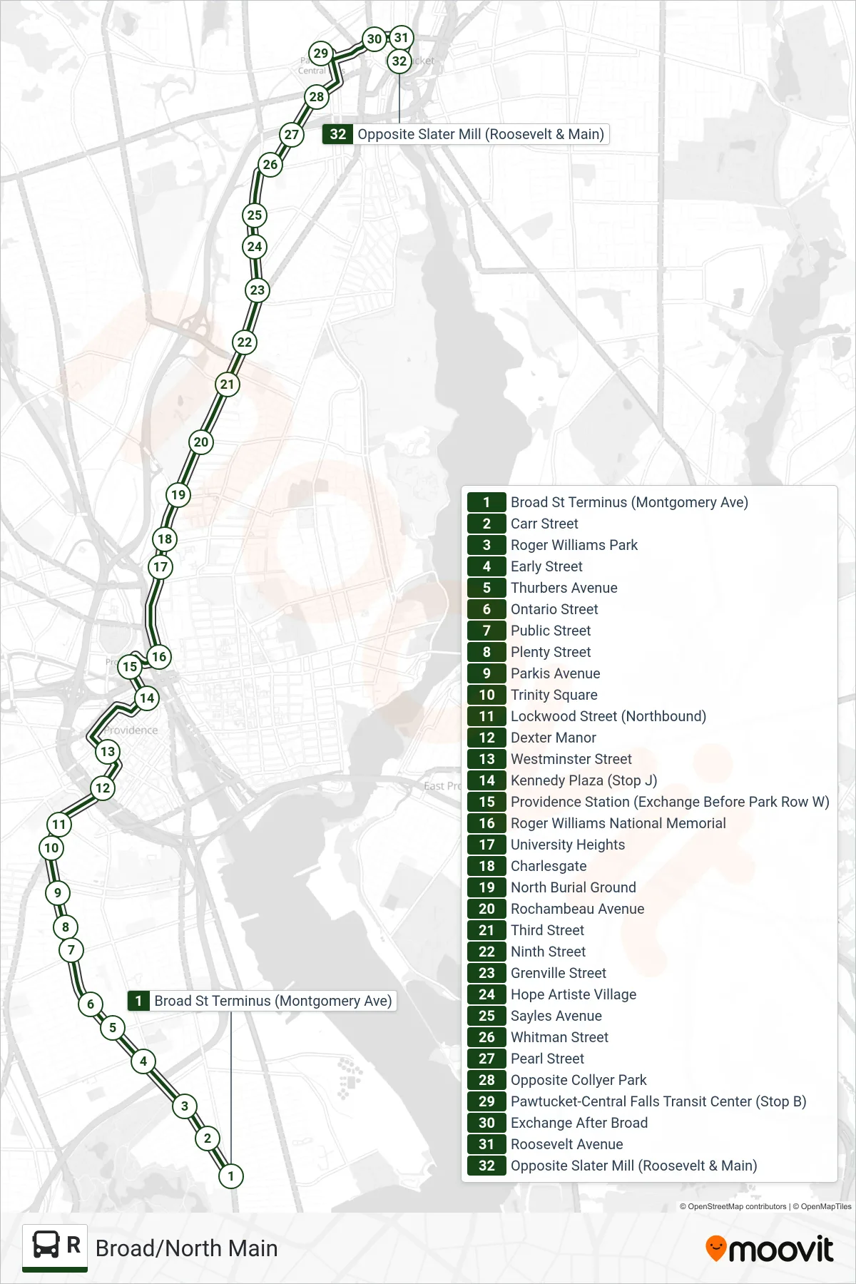
Stops list (R - Slater Mill (Pawtucket))
- Broad St Terminus (Montgomery Ave)
- Carr Street
- Roger Williams Park
- Early Street
- Thurbers Avenue
- Ontario Street
- Public Street
- Plenty Street
- Parkis Avenue
- Trinity Square
- Lockwood Street (Northbound)
- Dexter Manor
- Westminster Street
- Kennedy Plaza (Stop J)
- Providence Station (Exchange Before Park Row W)
- Roger Williams National Memorial
- University Heights
- Charlesgate
- North Burial Ground
- Rochambeau Avenue
- Third Street
- Ninth Street
- Grenville Street
- Hope Artiste Village
- Sayles Avenue
- Whitman Street
- Pearl Street
- Opposite Collyer Park
- Pawtucket-Central Falls Transit Center (Stop B)
- Exchange After Broad
- Roosevelt Avenue
- Opposite Slater Mill (Roosevelt & Main)