
R11 Bus Route Map
View the R11 route map and see all R11 stops along the route. The map of R11 shows where the bus travels and the location of each stop, making it easy to understand the entire route at a glance.
Explore Verkehrsbetriebe Westfalen-Süd routes on the map and see where Verkehrsbetriebe Westfalen-Süd bus services operate. Use the R11 map to find bus stops and see how the R11 connects different areas along its trip.
All R11 stops on the map are displayed in route order, helping you follow the R11 bus from the first stop to the last.
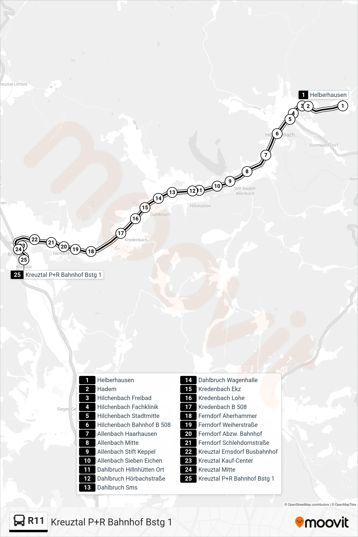
Stops list (R11 - Kreuztal P+R Bahnhof Bstg 1)
- Helberhausen
- Hadem
- Hilchenbach Freibad
- Hilchenbach Fachklinik
- Hilchenbach Stadtmitte
- Hilchenbach Bahnhof B 508
- Allenbach Haarhausen
- Allenbach Mitte
- Allenbach Stift Keppel
- Allenbach Sieben Eichen
- Dahlbruch Hillnhütten Ort
- Dahlbruch Hörbachstraße
- Dahlbruch Sms
- Dahlbruch Wagenhalle
- Kredenbach Ekz
- Kredenbach Lohe
- Kredenbach B 508
- Ferndorf Aherhammer
- Ferndorf Weiherstraße
- Ferndorf Abzw. Bahnhof
- Ferndorf Schlehdornstraße
- Kreuztal Ernsdorf Busbahnhof
- Kreuztal Kauf-Center
- Kreuztal Mitte
- Kreuztal P+R Bahnhof Bstg 1