
R2 Bus Route Map
View the R2 route map and see all R2 stops along the route. The map of R2 shows where the bus travels and the location of each stop, making it easy to understand the entire route at a glance.
Explore Kadamba Transport Corporation Ltd. routes on the map and see where Kadamba Transport Corporation Ltd. bus services operate. Use the R2 map to find bus stops and see how the R2 connects different areas along its trip.
All R2 stops on the map are displayed in route order, helping you follow the R2 bus from the first stop to the last.
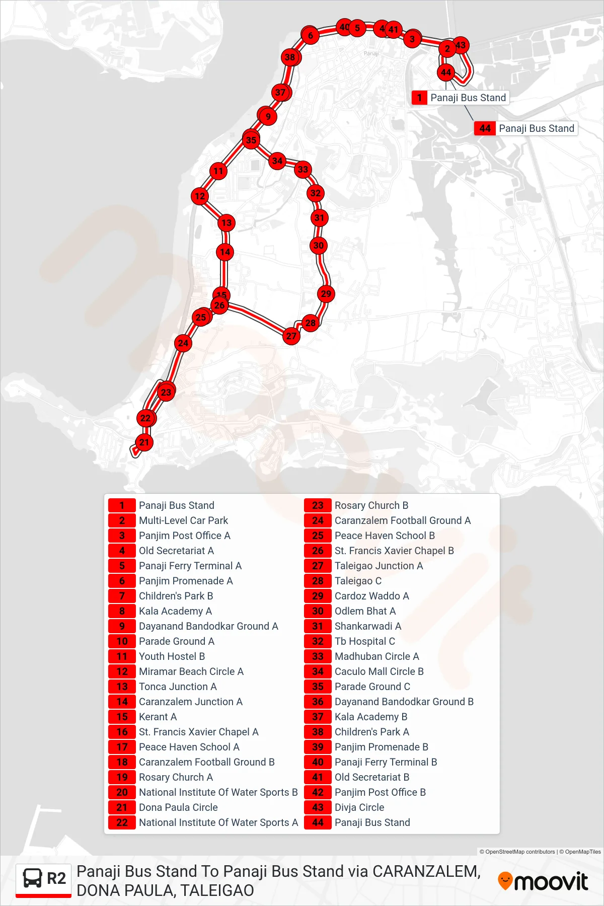
Stops list (R2 - Panaji-Dona Paula Circle-Taleigao Church-Panaji)
- Panaji Bus Stand
- Multi-Level Car Park
- Panjim Post Office A
- Old Secretariat A
- Panaji Ferry Terminal A
- Panjim Promenade A
- Children's Park B
- Kala Academy A
- Dayanand Bandodkar Ground A
- Parade Ground A
- Youth Hostel B
- Miramar Beach Circle A
- Tonca Junction A
- Caranzalem Junction A
- Kerant A
- St. Francis Xavier Chapel A
- Peace Haven School A
- Caranzalem Football Ground B
- Rosary Church A
- National Institute Of Water Sports B
- Dona Paula Circle
- National Institute Of Water Sports A
- Rosary Church B
- Caranzalem Football Ground A
- Peace Haven School B
- St. Francis Xavier Chapel B
- Taleigao Junction A
- Taleigao C
- Cardoz Waddo A
- Odlem Bhat A
- Shankarwadi A
- Tb Hospital C
- Madhuban Circle A
- Caculo Mall Circle B
- Parade Ground C
- Dayanand Bandodkar Ground B
- Kala Academy B
- Children's Park A
- Panjim Promenade B
- Panaji Ferry Terminal B
- Old Secretariat B
- Panjim Post Office B
- Divja Circle
- Panaji Bus Stand