
R20 Bus Route Map
View the R20 route map and see all R20 stops along the route. The map of R20 shows where the bus travels and the location of each stop, making it easy to understand the entire route at a glance.
Explore KreisVerkehr Schwäbisch Hall GmbH routes on the map and see where KreisVerkehr Schwäbisch Hall GmbH bus services operate. Use the R20 map to find bus stops and see how the R20 connects different areas along its trip.
All R20 stops on the map are displayed in route order, helping you follow the R20 bus from the first stop to the last.
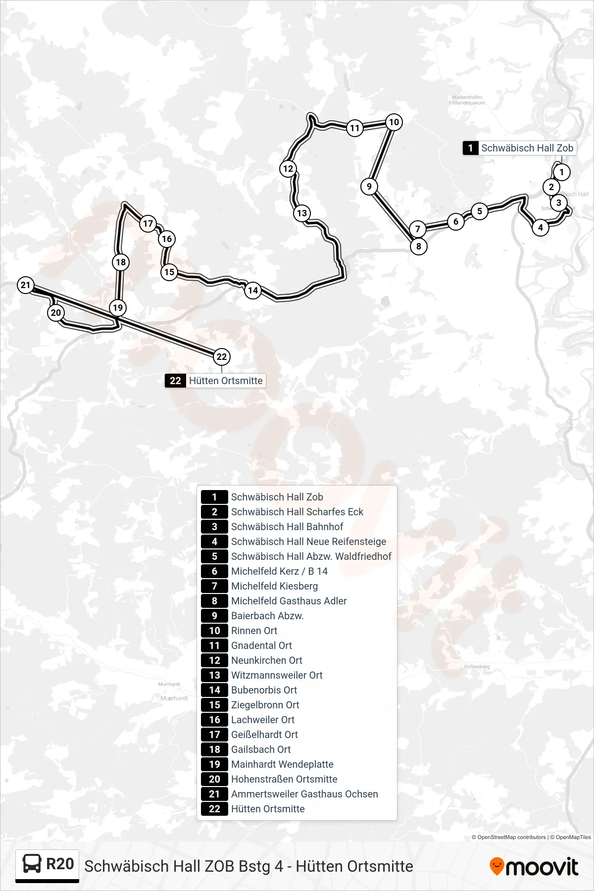
Stops list (R20 - Hütten Ortsmitte)
- Schwäbisch Hall Zob
- Schwäbisch Hall Scharfes Eck
- Schwäbisch Hall Bahnhof
- Schwäbisch Hall Neue Reifensteige
- Schwäbisch Hall Abzw. Waldfriedhof
- Michelfeld Kerz / B 14
- Michelfeld Kiesberg
- Michelfeld Gasthaus Adler
- Baierbach Abzw.
- Rinnen Ort
- Gnadental Ort
- Neunkirchen Ort
- Witzmannsweiler Ort
- Bubenorbis Ort
- Ziegelbronn Ort
- Lachweiler Ort
- Geißelhardt Ort
- Gailsbach Ort
- Mainhardt Wendeplatte
- Hohenstraßen Ortsmitte
- Ammertsweiler Gasthaus Ochsen
- Hütten Ortsmitte