
R33 Bus Route Map
View the R33 route map and see all R33 stops along the route. The map of R33 shows where the bus travels and the location of each stop, making it easy to understand the entire route at a glance.
Explore Verkehrsbetriebe Westfalen-Süd routes on the map and see where Verkehrsbetriebe Westfalen-Süd bus services operate. Use the R33 map to find bus stops and see how the R33 connects different areas along its trip.
All R33 stops on the map are displayed in route order, helping you follow the R33 bus from the first stop to the last.
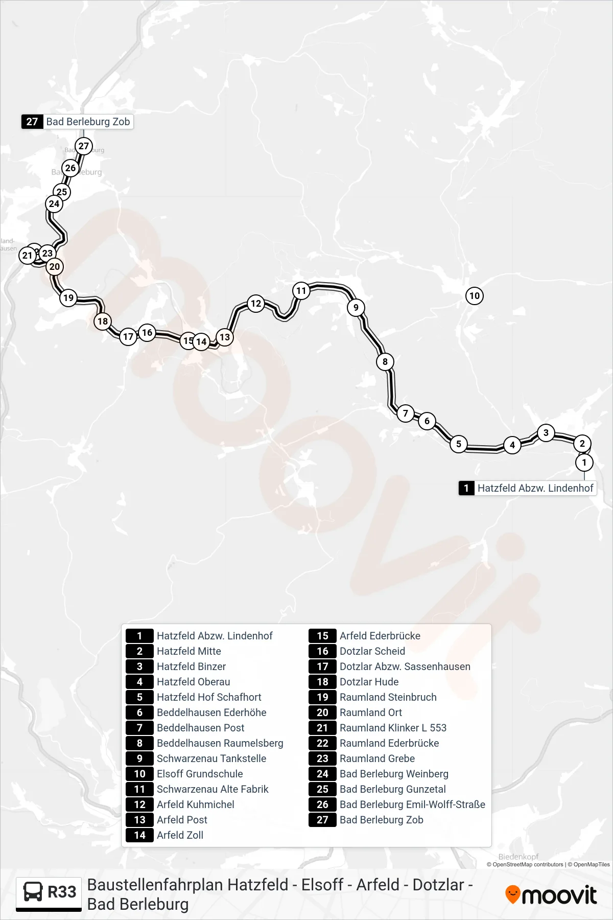
Stops list (R33 - Bad Berleburg Zob Bstg 2)
- Hatzfeld Abzw. Lindenhof
- Hatzfeld Mitte
- Hatzfeld Binzer
- Hatzfeld Oberau
- Hatzfeld Hof Schafhort
- Beddelhausen Ederhöhe
- Beddelhausen Post
- Beddelhausen Raumelsberg
- Schwarzenau Tankstelle
- Elsoff Grundschule
- Schwarzenau Alte Fabrik
- Arfeld Kuhmichel
- Arfeld Post
- Arfeld Zoll
- Arfeld Ederbrücke
- Dotzlar Scheid
- Dotzlar Abzw. Sassenhausen
- Dotzlar Hude
- Raumland Steinbruch
- Raumland Ort
- Raumland Klinker L 553
- Raumland Ederbrücke
- Raumland Grebe
- Bad Berleburg Weinberg
- Bad Berleburg Gunzetal
- Bad Berleburg Emil-Wolff-Straße
- Bad Berleburg Zob