
R42 Bus Route Map
View the R42 route map and see all R42 stops along the route. The map of R42 shows where the bus travels and the location of each stop, making it easy to understand the entire route at a glance.
Explore Verkehrsbetriebe Westfalen-Süd routes on the map and see where Verkehrsbetriebe Westfalen-Süd bus services operate. Use the R42 map to find bus stops and see how the R42 connects different areas along its trip.
All R42 stops on the map are displayed in route order, helping you follow the R42 bus from the first stop to the last.
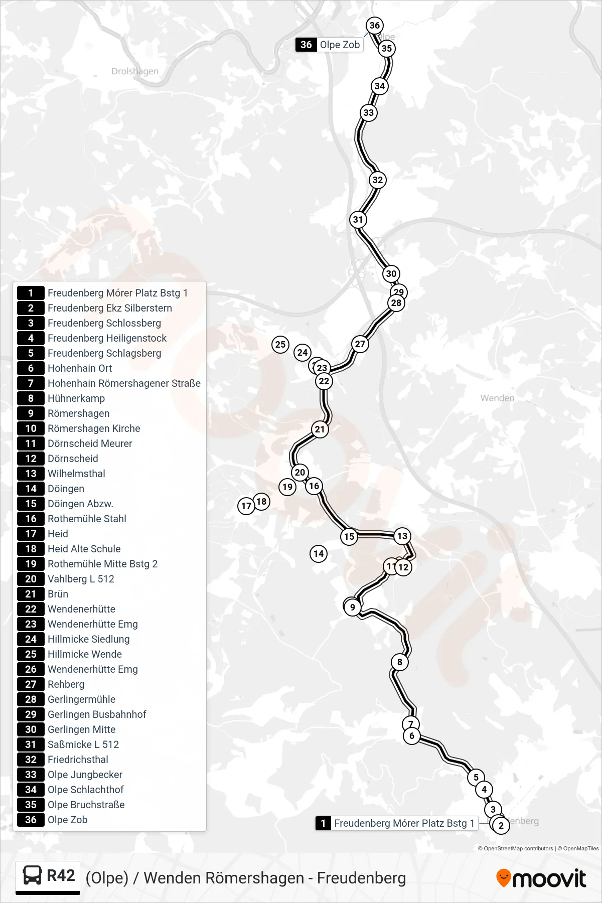
Stops list (R42 - Olpe Zob Bstg 10)
- Freudenberg Mórer Platz Bstg 1
- Freudenberg Ekz Silberstern
- Freudenberg Schlossberg
- Freudenberg Heiligenstock
- Freudenberg Schlagsberg
- Hohenhain Ort
- Hohenhain Römershagener Straße
- Hühnerkamp
- Römershagen
- Römershagen Kirche
- Dörnscheid Meurer
- Dörnscheid
- Wilhelmsthal
- Döingen
- Döingen Abzw.
- Rothemühle Stahl
- Heid
- Heid Alte Schule
- Rothemühle Mitte Bstg 2
- Vahlberg L 512
- Brün
- Wendenerhütte
- Wendenerhütte Emg
- Hillmicke Siedlung
- Hillmicke Wende
- Wendenerhütte Emg
- Rehberg
- Gerlingermühle
- Gerlingen Busbahnhof
- Gerlingen Mitte
- Saßmicke L 512
- Friedrichsthal
- Olpe Jungbecker
- Olpe Schlachthof
- Olpe Bruchstraße
- Olpe Zob
Change direction
- Route Map - R42 - Döingen
- Route Map - R42 - Rothemühle Mitte Bstg 3
- Route Map - R42 - Gerlingen Busbahnhof
- Route Map - R42 - Römershagen Kirche
- Route Map - R42 - Rothemühle Schule
- Route Map - R42 - Wenden Rathaus
- Route Map - R42 - Wenden Schulzentrum
- Route Map - R42 - Freudenberg Mórer Platz Bstg 2
- Route Map - R42 - Rothemühle Mitte Bstg 1
- Route Map - R42 - Dörnscheid