
R51 Bus Route Map
View the R51 route map and see all R51 stops along the route. The map of R51 shows where the bus travels and the location of each stop, making it easy to understand the entire route at a glance.
Explore Verkehrsbetriebe Westfalen-Süd routes on the map and see where Verkehrsbetriebe Westfalen-Süd bus services operate. Use the R51 map to find bus stops and see how the R51 connects different areas along its trip.
All R51 stops on the map are displayed in route order, helping you follow the R51 bus from the first stop to the last.
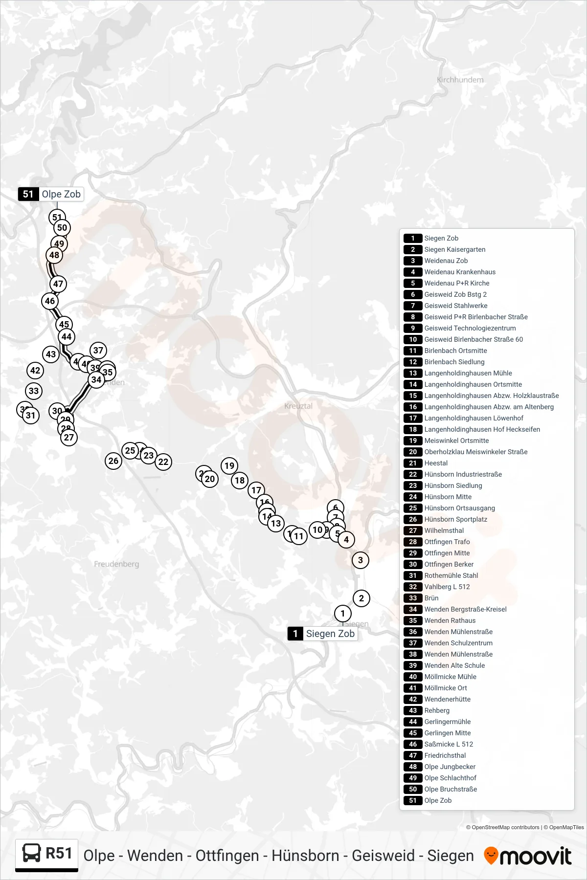
Stops list (R51 - Olpe Zob Bstg 10)
- Siegen Zob
- Siegen Kaisergarten
- Weidenau Zob
- Weidenau Krankenhaus
- Weidenau P+R Kirche
- Geisweid Zob Bstg 2
- Geisweid Stahlwerke
- Geisweid P+R Birlenbacher Straße
- Geisweid Technologiezentrum
- Geisweid Birlenbacher Straße 60
- Birlenbach Ortsmitte
- Birlenbach Siedlung
- Langenholdinghausen Mühle
- Langenholdinghausen Ortsmitte
- Langenholdinghausen Abzw. Holzklaustraße
- Langenholdinghausen Abzw. am Altenberg
- Langenholdinghausen Löwenhof
- Langenholdinghausen Hof Heckseifen
- Meiswinkel Ortsmitte
- Oberholzklau Meiswinkeler Straße
- Heestal
- Hünsborn Industriestraße
- Hünsborn Siedlung
- Hünsborn Mitte
- Hünsborn Ortsausgang
- Hünsborn Sportplatz
- Wilhelmsthal
- Ottfingen Trafo
- Ottfingen Mitte
- Ottfingen Berker
- Rothemühle Stahl
- Vahlberg L 512
- Brün
- Wenden Bergstraße-Kreisel
- Wenden Rathaus
- Wenden Mühlenstraße
- Wenden Schulzentrum
- Wenden Mühlenstraße
- Wenden Alte Schule
- Möllmicke Mühle
- Möllmicke Ort
- Wendenerhütte
- Rehberg
- Gerlingermühle
- Gerlingen Mitte
- Saßmicke L 512
- Friedrichsthal
- Olpe Jungbecker
- Olpe Schlachthof
- Olpe Bruchstraße
- Olpe Zob