
R52 Bus Route Map
View the R52 route map and see all R52 stops along the route. The map of R52 shows where the bus travels and the location of each stop, making it easy to understand the entire route at a glance.
Explore Verkehrsbetriebe Westfalen-Süd routes on the map and see where Verkehrsbetriebe Westfalen-Süd bus services operate. Use the R52 map to find bus stops and see how the R52 connects different areas along its trip.
All R52 stops on the map are displayed in route order, helping you follow the R52 bus from the first stop to the last.
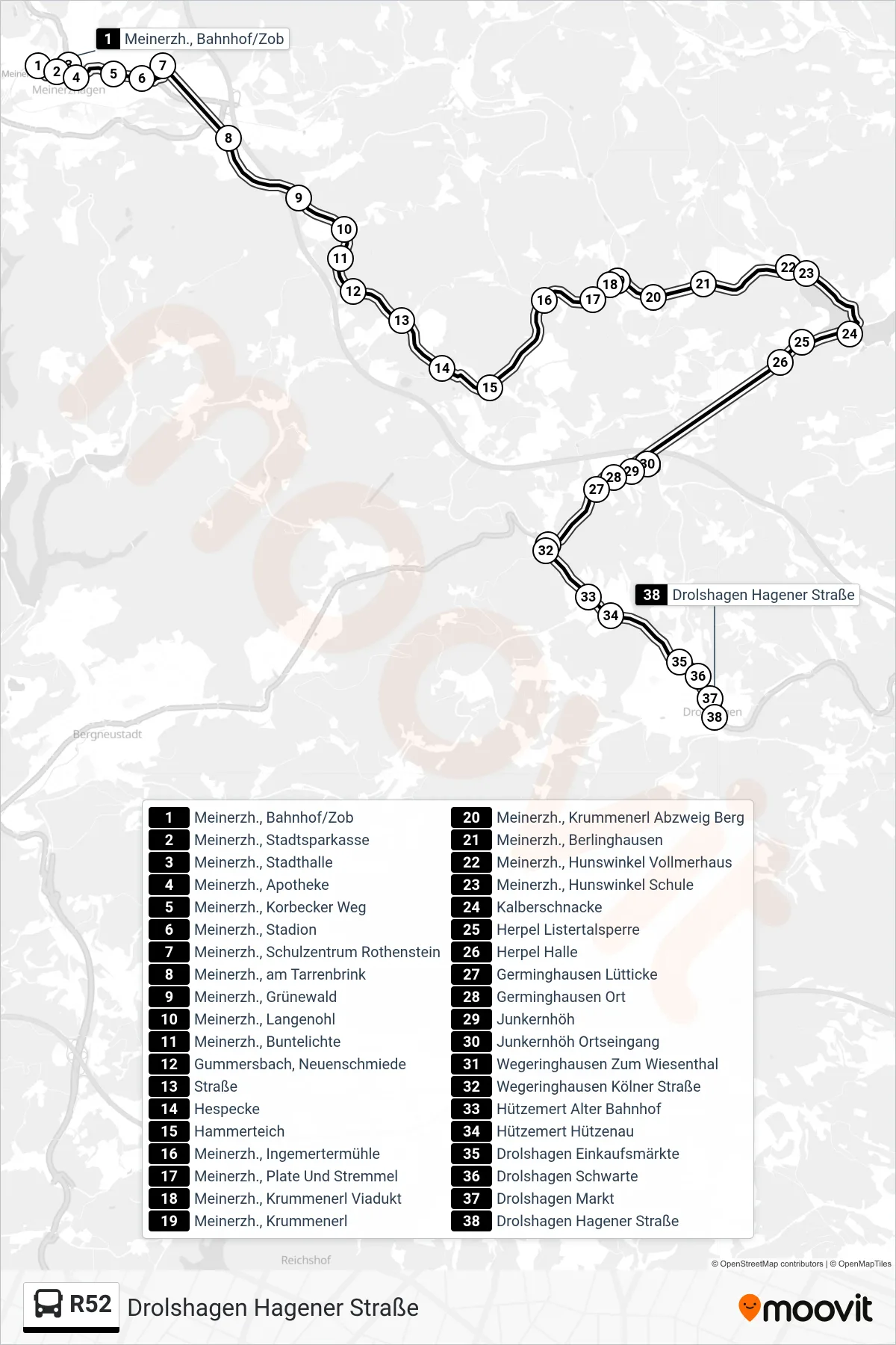
Stops list (R52 - Drolshagen Hagener Straße)
- Meinerzh., Bahnhof/Zob
- Meinerzh., Stadtsparkasse
- Meinerzh., Stadthalle
- Meinerzh., Apotheke
- Meinerzh., Korbecker Weg
- Meinerzh., Stadion
- Meinerzh., Schulzentrum Rothenstein
- Meinerzh., am Tarrenbrink
- Meinerzh., Grünewald
- Meinerzh., Langenohl
- Meinerzh., Buntelichte
- Gummersbach, Neuenschmiede
- Straße
- Hespecke
- Hammerteich
- Meinerzh., Ingemertermühle
- Meinerzh., Plate Und Stremmel
- Meinerzh., Krummenerl Viadukt
- Meinerzh., Krummenerl
- Meinerzh., Krummenerl Abzweig Berg
- Meinerzh., Berlinghausen
- Meinerzh., Hunswinkel Vollmerhaus
- Meinerzh., Hunswinkel Schule
- Kalberschnacke
- Herpel Listertalsperre
- Herpel Halle
- Germinghausen Lütticke
- Germinghausen Ort
- Junkernhöh
- Junkernhöh Ortseingang
- Wegeringhausen Zum Wiesenthal
- Wegeringhausen Kölner Straße
- Hützemert Alter Bahnhof
- Hützemert Hützenau
- Drolshagen Einkaufsmärkte
- Drolshagen Schwarte
- Drolshagen Markt
- Drolshagen Hagener Straße
Change direction
- Route Map - R52 - Drolshagen Markt
- Route Map - R52 - Olpe Zob Bstg 9
- Route Map - R52 - Hützemert Alter Bahnhof
- Route Map - R52 - Drolshagen Voßhölzchen
- Route Map - R52 - Wegeringhausen Mitte
- Route Map - R52 - Breitehardt
- Route Map - R52 - Drolshagen Grundschule
- Route Map - R52 - Wegeringhausen Mitte
- Route Map - R52 - Drolshagen Markt
- Route Map - R52 - Schlenke
- Route Map - R52 - Drolshagen Sekundarschule
- Route Map - R52 - Hespecke
- Route Map - R52 - Meinerzh., Bahnhof/Zob - Steig 6 : Linien 80, 282, 296, R52