
R59 Bus Route Map
View the R59 route map and see all R59 stops along the route. The map of R59 shows where the bus travels and the location of each stop, making it easy to understand the entire route at a glance.
Explore KreisVerkehr Schwäbisch Hall GmbH routes on the map and see where KreisVerkehr Schwäbisch Hall GmbH bus services operate. Use the R59 map to find bus stops and see how the R59 connects different areas along its trip.
All R59 stops on the map are displayed in route order, helping you follow the R59 bus from the first stop to the last.
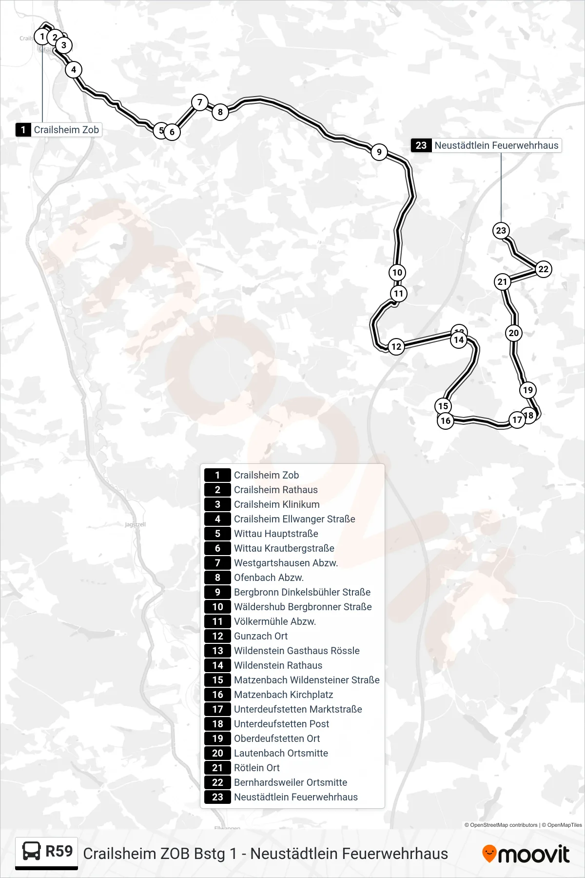
Stops list (R59 - Neustädtlein Feuerwehrhaus)
- Crailsheim Zob
- Crailsheim Rathaus
- Crailsheim Klinikum
- Crailsheim Ellwanger Straße
- Wittau Hauptstraße
- Wittau Krautbergstraße
- Westgartshausen Abzw.
- Ofenbach Abzw.
- Bergbronn Dinkelsbühler Straße
- Wäldershub Bergbronner Straße
- Völkermühle Abzw.
- Gunzach Ort
- Wildenstein Gasthaus Rössle
- Wildenstein Rathaus
- Matzenbach Wildensteiner Straße
- Matzenbach Kirchplatz
- Unterdeufstetten Marktstraße
- Unterdeufstetten Post
- Oberdeufstetten Ort
- Lautenbach Ortsmitte
- Rötlein Ort
- Bernhardsweiler Ortsmitte
- Neustädtlein Feuerwehrhaus