
R6 Bus Route Map
View the R6 route map and see all R6 stops along the route. The map of R6 shows where the bus travels and the location of each stop, making it easy to understand the entire route at a glance.
Explore Gary Public Transit routes on the map and see where Gary Public Transit bus services operate. Use the R6 map to find bus stops and see how the R6 connects different areas along its trip.
All R6 stops on the map are displayed in route order, helping you follow the R6 bus from the first stop to the last.
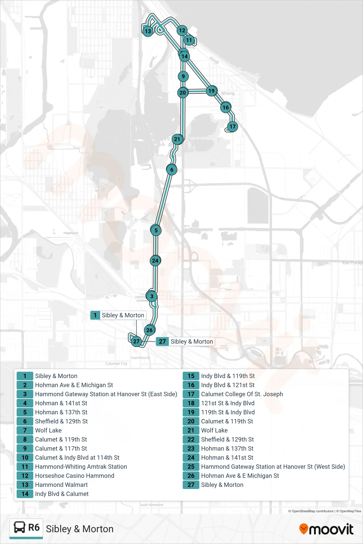
Stops list (R6 - Sibley & Morton)
- Sibley & Morton
- Hohman Ave & E Michigan St
- Hammond Gateway Station at Hanover St (East Side)
- Hohman & 141st St
- Hohman & 137th St
- Sheffield & 129th St
- Wolf Lake
- Calumet & 119th St
- Calumet & 117th St
- Calumet & Indy Blvd at 114th St
- Hammond-Whiting Amtrak Station
- Horseshoe Casino Hammond
- Hammond Walmart
- Indy Blvd & Calumet
- Indy Blvd & 119th St
- Indy Blvd & 121st St
- Calumet College Of St. Joseph
- 121st St & Indy Blvd
- 119th St & Indy Blvd
- Calumet & 119th St
- Wolf Lake
- Sheffield & 129th St
- Hohman & 137th St
- Hohman & 141st St
- Hammond Gateway Station at Hanover St (West Side)
- Hohman Ave & E Michigan St
- Sibley & Morton