
R64 Bus Route Map
View the R64 route map and see all R64 stops along the route. The map of R64 shows where the bus travels and the location of each stop, making it easy to understand the entire route at a glance.
Explore Veelker GmbH & Co.KG routes on the map and see where Veelker GmbH & Co.KG bus services operate. Use the R64 map to find bus stops and see how the R64 connects different areas along its trip.
All R64 stops on the map are displayed in route order, helping you follow the R64 bus from the first stop to the last.
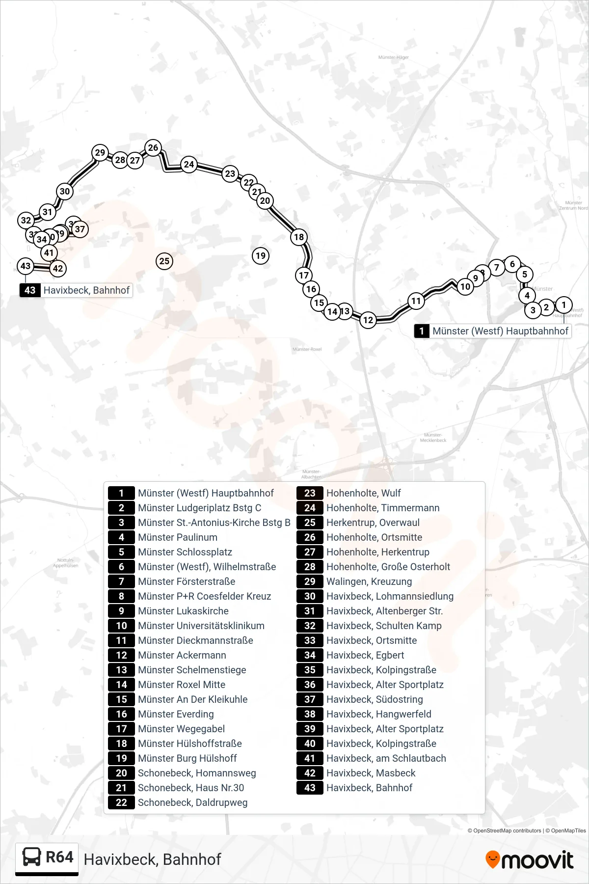
Stops list (R64 - Havixbeck, Bahnhof)
- Münster (Westf) Hauptbahnhof
- Münster Ludgeriplatz Bstg C
- Münster St.-Antonius-Kirche Bstg B
- Münster Paulinum
- Münster Schlossplatz
- Münster (Westf), Wilhelmstraße
- Münster Försterstraße
- Münster P+R Coesfelder Kreuz
- Münster Lukaskirche
- Münster Universitätsklinikum
- Münster Dieckmannstraße
- Münster Ackermann
- Münster Schelmenstiege
- Münster Roxel Mitte
- Münster An Der Kleikuhle
- Münster Everding
- Münster Wegegabel
- Münster Hülshoffstraße
- Münster Burg Hülshoff
- Schonebeck, Homannsweg
- Schonebeck, Haus Nr.30
- Schonebeck, Daldrupweg
- Hohenholte, Wulf
- Hohenholte, Timmermann
- Herkentrup, Overwaul
- Hohenholte, Ortsmitte
- Hohenholte, Herkentrup
- Hohenholte, Große Osterholt
- Walingen, Kreuzung
- Havixbeck, Lohmannsiedlung
- Havixbeck, Altenberger Str.
- Havixbeck, Schulten Kamp
- Havixbeck, Ortsmitte
- Havixbeck, Egbert
- Havixbeck, Kolpingstraße
- Havixbeck, Alter Sportplatz
- Havixbeck, Südostring
- Havixbeck, Hangwerfeld
- Havixbeck, Alter Sportplatz
- Havixbeck, Kolpingstraße
- Havixbeck, am Schlautbach
- Havixbeck, Masbeck
- Havixbeck, Bahnhof