
RB2 Bus Route Map
View the RB2 route map and see all RB2 stops along the route. The map of RB2 shows where the bus travels and the location of each stop, making it easy to understand the entire route at a glance.
Explore Karlsruher Verkehrsverbund routes on the map and see where Karlsruher Verkehrsverbund bus services operate. Use the RB2 map to find bus stops and see how the RB2 connects different areas along its trip.
All RB2 stops on the map are displayed in route order, helping you follow the RB2 bus from the first stop to the last.
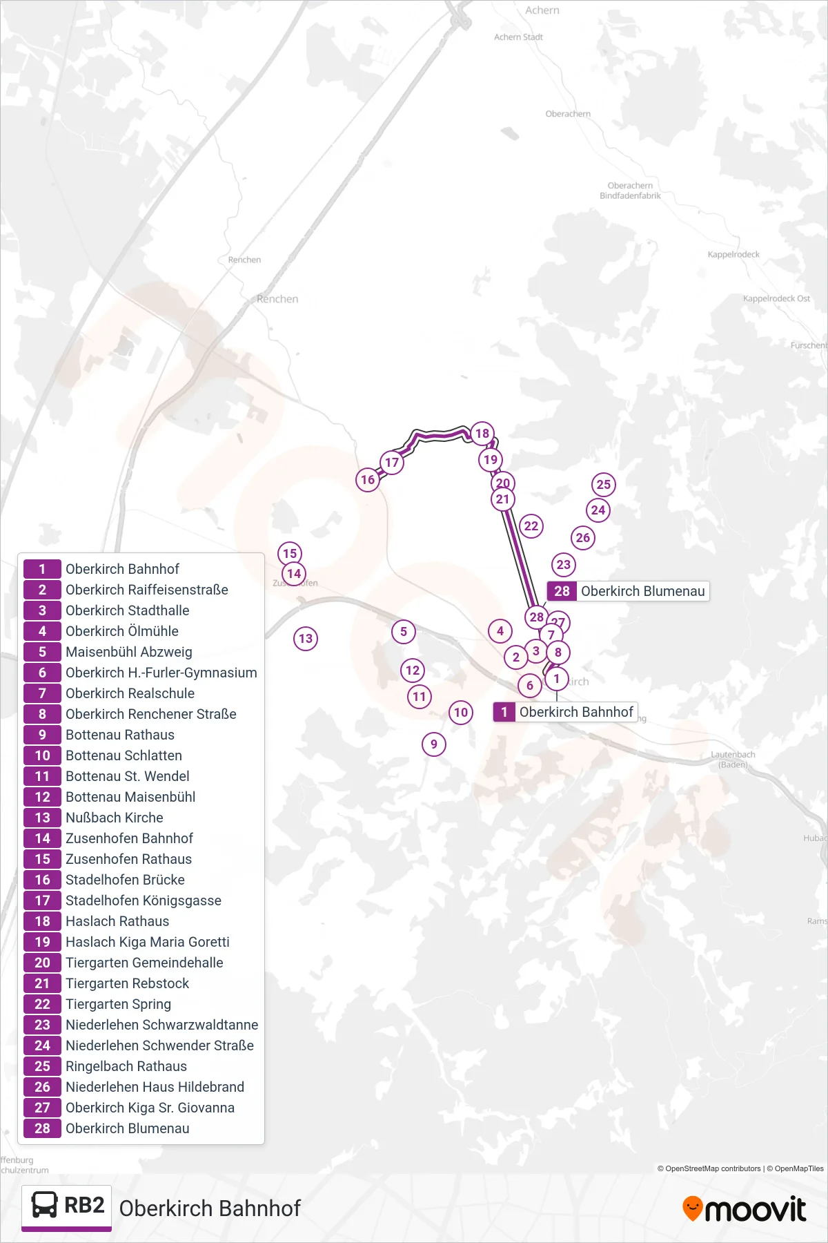
Stops list (RB2 - Oberkirch Bahnhof)
- Oberkirch Bahnhof
- Oberkirch Raiffeisenstraße
- Oberkirch Stadthalle
- Oberkirch Ölmühle
- Maisenbühl Abzweig
- Oberkirch H.-Furler-Gymnasium
- Oberkirch Realschule
- Oberkirch Renchener Straße
- Bottenau Rathaus
- Bottenau Schlatten
- Bottenau St. Wendel
- Bottenau Maisenbühl
- Nußbach Kirche
- Zusenhofen Bahnhof
- Zusenhofen Rathaus
- Stadelhofen Brücke
- Stadelhofen Königsgasse
- Haslach Rathaus
- Haslach Kiga Maria Goretti
- Tiergarten Gemeindehalle
- Tiergarten Rebstock
- Tiergarten Spring
- Niederlehen Schwarzwaldtanne
- Niederlehen Schwender Straße
- Ringelbach Rathaus
- Niederlehen Haus Hildebrand
- Oberkirch Kiga Sr. Giovanna
- Oberkirch Blumenau