
RED Bus Route Map
View the RED route map and see all RED stops along the route. The map of RED shows where the bus travels and the location of each stop, making it easy to understand the entire route at a glance.
Explore Orange Line routes on the map and see where Orange Line bus services operate. Use the RED map to find bus stops and see how the RED connects different areas along its trip.
All RED stops on the map are displayed in route order, helping you follow the RED bus from the first stop to the last.
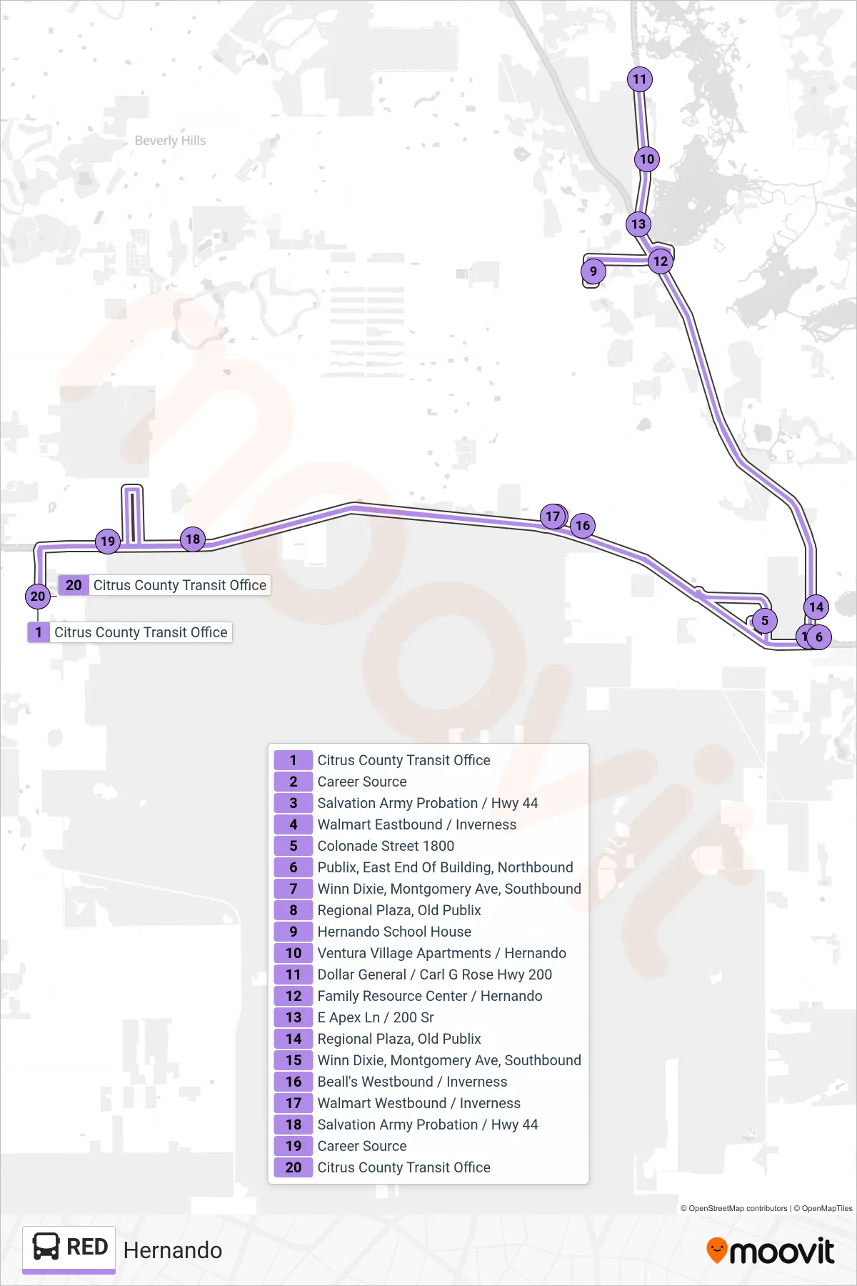
Stops list (RED - Loop)
- Citrus County Transit Office
- Career Source
- Salvation Army Probation / Hwy 44
- Walmart Eastbound / Inverness
- Colonade Street 1800
- Publix, East End Of Building, Northbound
- Winn Dixie, Montgomery Ave, Southbound
- Regional Plaza, Old Publix
- Hernando School House
- Ventura Village Apartments / Hernando
- Dollar General / Carl G Rose Hwy 200
- Family Resource Center / Hernando
- E Apex Ln / 200 Sr
- Regional Plaza, Old Publix
- Winn Dixie, Montgomery Ave, Southbound
- Beall's Westbound / Inverness
- Walmart Westbound / Inverness
- Salvation Army Probation / Hwy 44
- Career Source
- Citrus County Transit Office