
RED Bus Route Map
View the RED route map and see all RED stops along the route. The map of RED shows where the bus travels and the location of each stop, making it easy to understand the entire route at a glance.
Explore FL_Hernando routes on the map and see where FL_Hernando bus services operate. Use the RED map to find bus stops and see how the RED connects different areas along its trip.
All RED stops on the map are displayed in route order, helping you follow the RED bus from the first stop to the last.
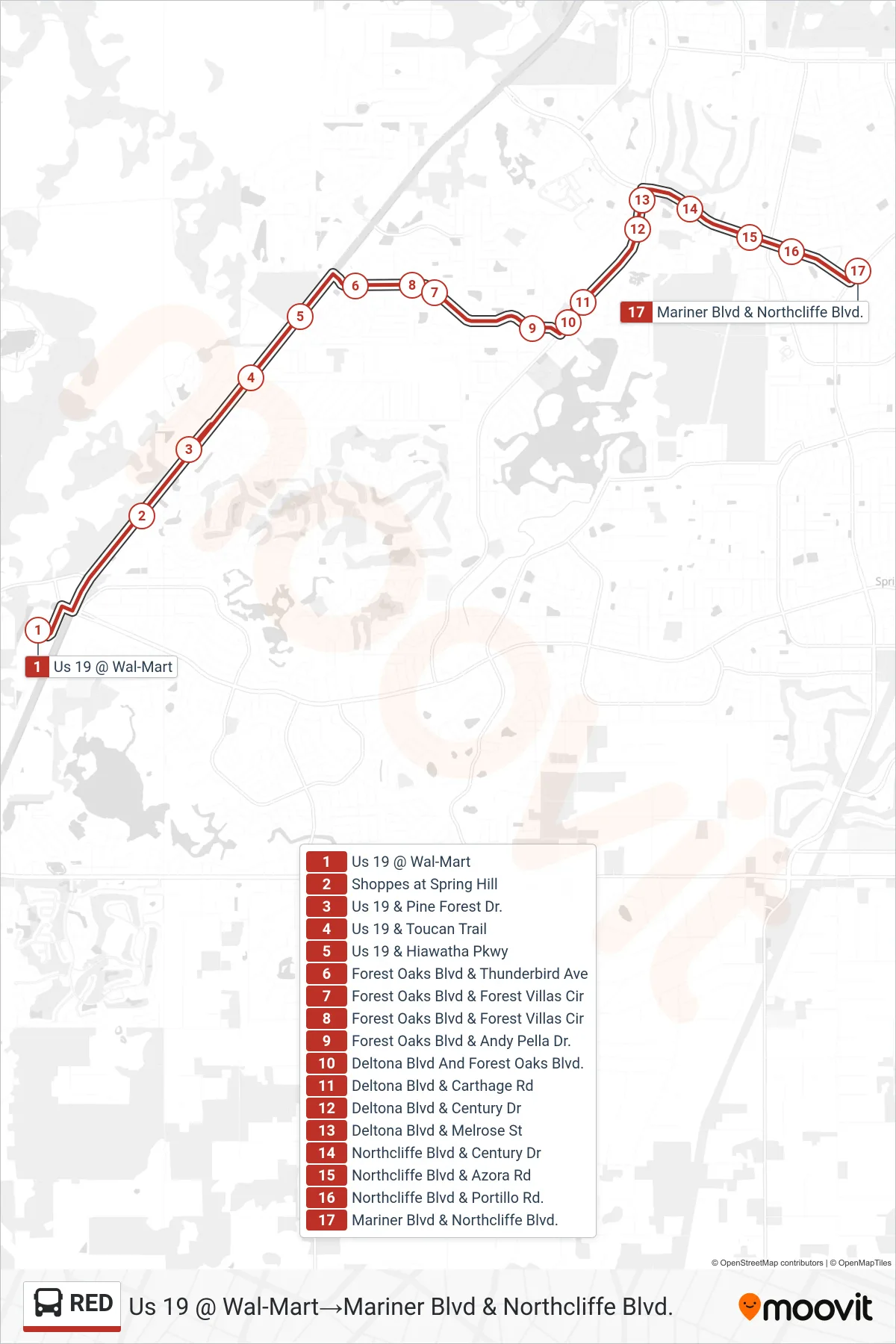
Stops list (RED - Us 19 @ Wal-Mart→Mariner Blvd & Northcliffe Blvd.)
- Us 19 @ Wal-Mart
- Shoppes at Spring Hill
- Us 19 & Pine Forest Dr.
- Us 19 & Toucan Trail
- Us 19 & Hiawatha Pkwy
- Forest Oaks Blvd & Thunderbird Ave
- Forest Oaks Blvd & Forest Villas Cir
- Forest Oaks Blvd & Forest Villas Cir
- Forest Oaks Blvd & Andy Pella Dr.
- Deltona Blvd And Forest Oaks Blvd.
- Deltona Blvd & Carthage Rd
- Deltona Blvd & Century Dr
- Deltona Blvd & Melrose St
- Northcliffe Blvd & Century Dr
- Northcliffe Blvd & Azora Rd
- Northcliffe Blvd & Portillo Rd.
- Mariner Blvd & Northcliffe Blvd.