
RED Bus Route Map
View the RED route map and see all RED stops along the route. The map of RED shows where the bus travels and the location of each stop, making it easy to understand the entire route at a glance.
Explore Mountain Rides Transportation Authority (MRTA) routes on the map and see where Mountain Rides Transportation Authority (MRTA) bus services operate. Use the RED map to find bus stops and see how the RED connects different areas along its trip.
All RED stops on the map are displayed in route order, helping you follow the RED bus from the first stop to the last.
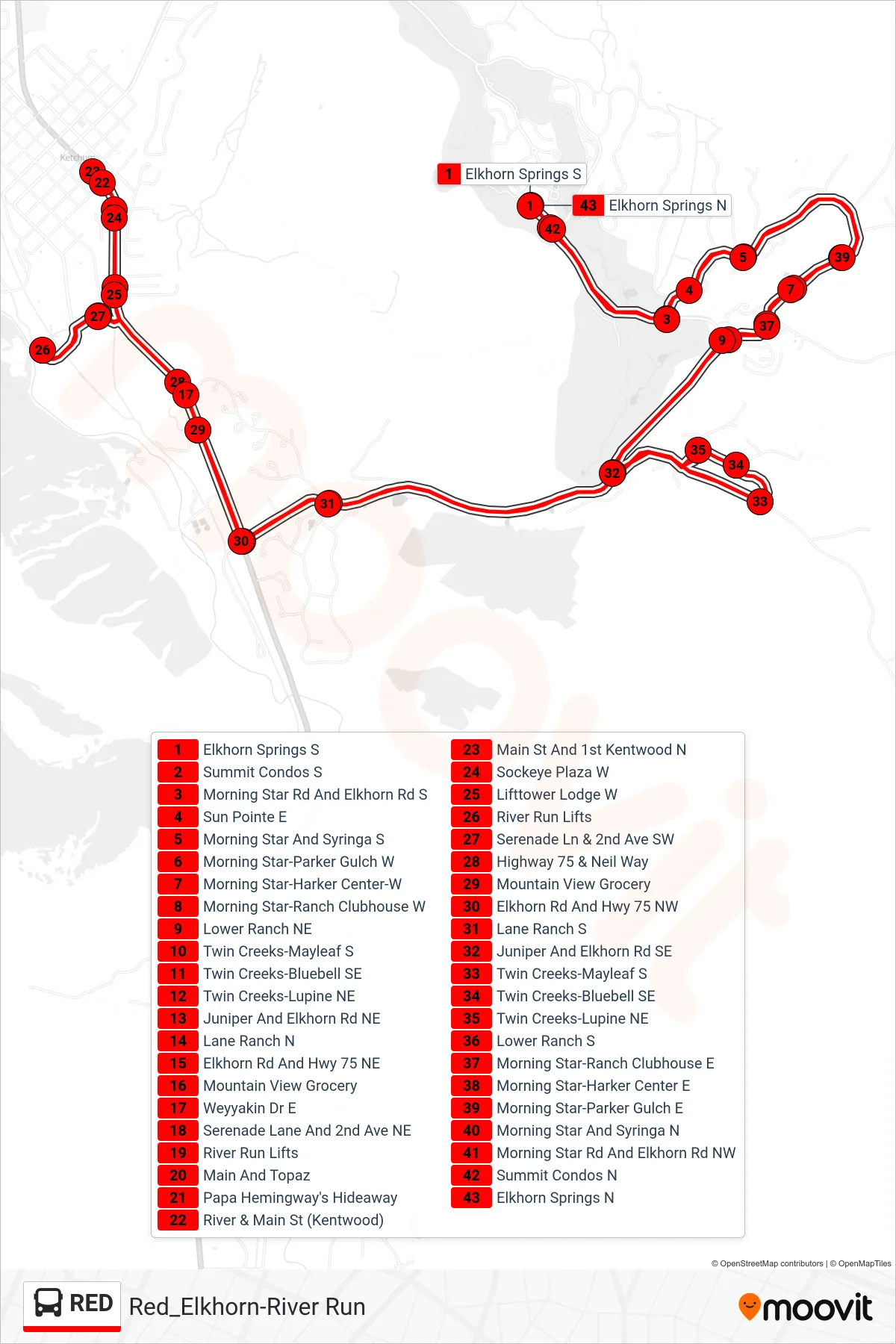
Stops list (RED - Elkhorn Springs S→Elkhorn Springs N)
- Elkhorn Springs S
- Summit Condos S
- Morning Star Rd And Elkhorn Rd S
- Sun Pointe E
- Morning Star And Syringa S
- Morning Star-Parker Gulch W
- Morning Star-Harker Center-W
- Morning Star-Ranch Clubhouse W
- Lower Ranch NE
- Twin Creeks-Mayleaf S
- Twin Creeks-Bluebell SE
- Twin Creeks-Lupine NE
- Juniper And Elkhorn Rd NE
- Lane Ranch N
- Elkhorn Rd And Hwy 75 NE
- Mountain View Grocery
- Weyyakin Dr E
- Serenade Lane And 2nd Ave NE
- River Run Lifts
- Main And Topaz
- Papa Hemingway's Hideaway
- River & Main St (Kentwood)
- Main St And 1st Kentwood N
- Sockeye Plaza W
- Lifttower Lodge W
- River Run Lifts
- Serenade Ln & 2nd Ave SW
- Highway 75 & Neil Way
- Mountain View Grocery
- Elkhorn Rd And Hwy 75 NW
- Lane Ranch S
- Juniper And Elkhorn Rd SE
- Twin Creeks-Mayleaf S
- Twin Creeks-Bluebell SE
- Twin Creeks-Lupine NE
- Lower Ranch S
- Morning Star-Ranch Clubhouse E
- Morning Star-Harker Center E
- Morning Star-Parker Gulch E
- Morning Star And Syringa N
- Morning Star Rd And Elkhorn Rd NW
- Summit Condos N
- Elkhorn Springs N