
RED Bus Route Map
View the RED route map and see all RED stops along the route. The map of RED shows where the bus travels and the location of each stop, making it easy to understand the entire route at a glance.
Explore Urban Transport Agrigento routes on the map and see where Urban Transport Agrigento bus services operate. Use the RED map to find bus stops and see how the RED connects different areas along its trip.
All RED stops on the map are displayed in route order, helping you follow the RED bus from the first stop to the last.
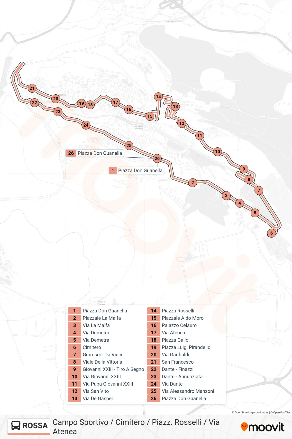
Stops list (RED - Sports Field / Cemetery / Piazzale Rosselli / Via Atenea)
- Don Guanella Square
- La Malfa Square
- La Malfa Street
- Demetra Street
- Demetra Street
- Cemetery
- Gramsci - Da Vinci
- Victory Avenue
- John XXIII - Shooting Range
- Giovanni XXIII Street
- Pope John XXIII Street
- San Vito Street
- De Gasperi Street
- Rosselli Square
- Aldo Moro Square
- Celauro Palace
- Via Atenea
- Gallo Square
- Luigi Pirandello Square
- Garibaldi Street
- San Francesco
- Dante - Finazzi
- Dante - Annunciation
- Dante Street
- Alessandro Manzoni Street
- Don Guanella Square