
RED Light Rail Route Map
View the RED route map and see all RED stops along the route. The map of RED shows where the light rail travels and the location of each stop, making it easy to understand the entire route at a glance.
Explore TriMet routes on the map and see where TriMet light rail services operate. Use the RED map to find light rail stations and see how the RED connects different areas along its trip.
All RED stops on the map are displayed in route order, helping you follow the RED light rail from the first station to the last.
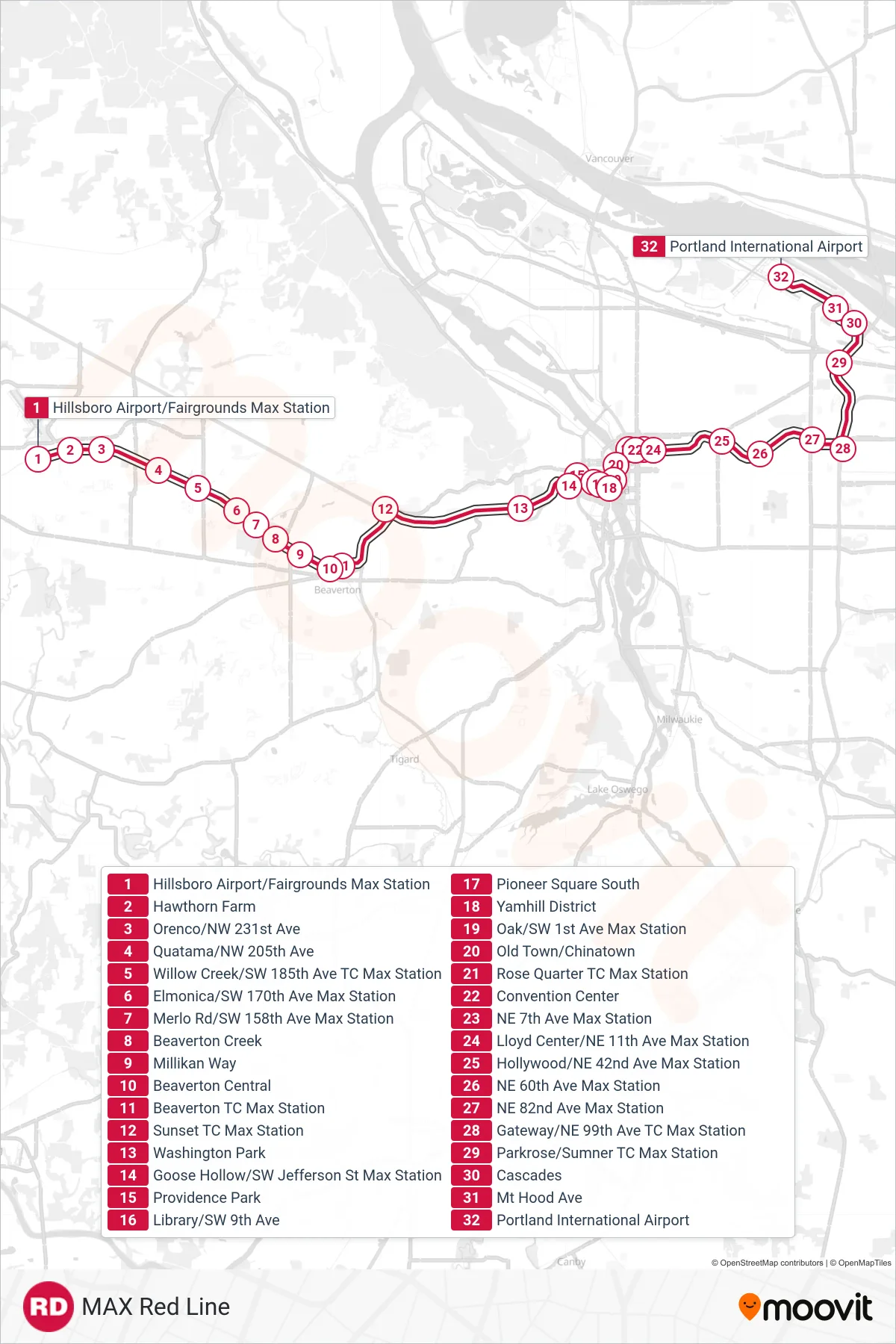
Stops list (RED - Portland Int'L Airport Max Station)
- Hillsboro Airport/Fairgrounds Max Station
- Hawthorn Farm
- Orenco/NW 231st Ave
- Quatama/NW 205th Ave
- Willow Creek/SW 185th Ave TC Max Station
- Elmonica/SW 170th Ave Max Station
- Merlo Rd/SW 158th Ave Max Station
- Beaverton Creek
- Millikan Way
- Beaverton Central
- Beaverton TC Max Station
- Sunset TC Max Station
- Washington Park
- Goose Hollow/SW Jefferson St Max Station
- Providence Park
- Library/SW 9th Ave
- Pioneer Square South
- Yamhill District
- Oak/SW 1st Ave Max Station
- Old Town/Chinatown
- Rose Quarter TC Max Station
- Convention Center
- NE 7th Ave Max Station
- Lloyd Center/NE 11th Ave Max Station
- Hollywood/NE 42nd Ave Max Station
- NE 60th Ave Max Station
- NE 82nd Ave Max Station
- Gateway/NE 99th Ave TC Max Station
- Parkrose/Sumner TC Max Station
- Cascades
- Mt Hood Ave
- Portland International Airport