
RED Bus Route Map
View the RED route map and see all RED stops along the route. The map of RED shows where the bus travels and the location of each stop, making it easy to understand the entire route at a glance.
Explore Annapolis Transit routes on the map and see where Annapolis Transit bus services operate. Use the RED map to find bus stops and see how the RED connects different areas along its trip.
All RED stops on the map are displayed in route order, helping you follow the RED bus from the first stop to the last.
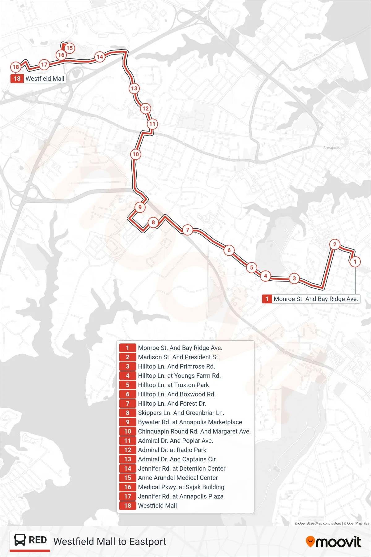
Stops list (RED - Westfield Mall)
- Monroe St. And Bay Ridge Ave.
- Madison St. And President St.
- Hilltop Ln. And Primrose Rd.
- Hilltop Ln. at Youngs Farm Rd.
- Hilltop Ln. at Truxton Park
- Hilltop Ln. And Boxwood Rd.
- Hilltop Ln. And Forest Dr.
- Skippers Ln. And Greenbriar Ln.
- Bywater Rd. at Annapolis Marketplace
- Chinquapin Round Rd. And Margaret Ave.
- Admiral Dr. And Poplar Ave.
- Admiral Dr. at Radio Park
- Admiral Dr. And Captains Cir.
- Jennifer Rd. at Detention Center
- Anne Arundel Medical Center
- Medical Pkwy. at Sajak Building
- Jennifer Rd. at Annapolis Plaza
- Westfield Mall