
RED Metro Route Map
View the RED route map and see all RED stops along the route. The map of RED shows where the metro travels and the location of each stop, making it easy to understand the entire route at a glance.
Explore WMATA routes on the map and see where WMATA metro services operate. Use the RED map to find metro stations and see how the RED connects different areas along its trip.
All RED stops on the map are displayed in route order, helping you follow the RED metro from the first station to the last.
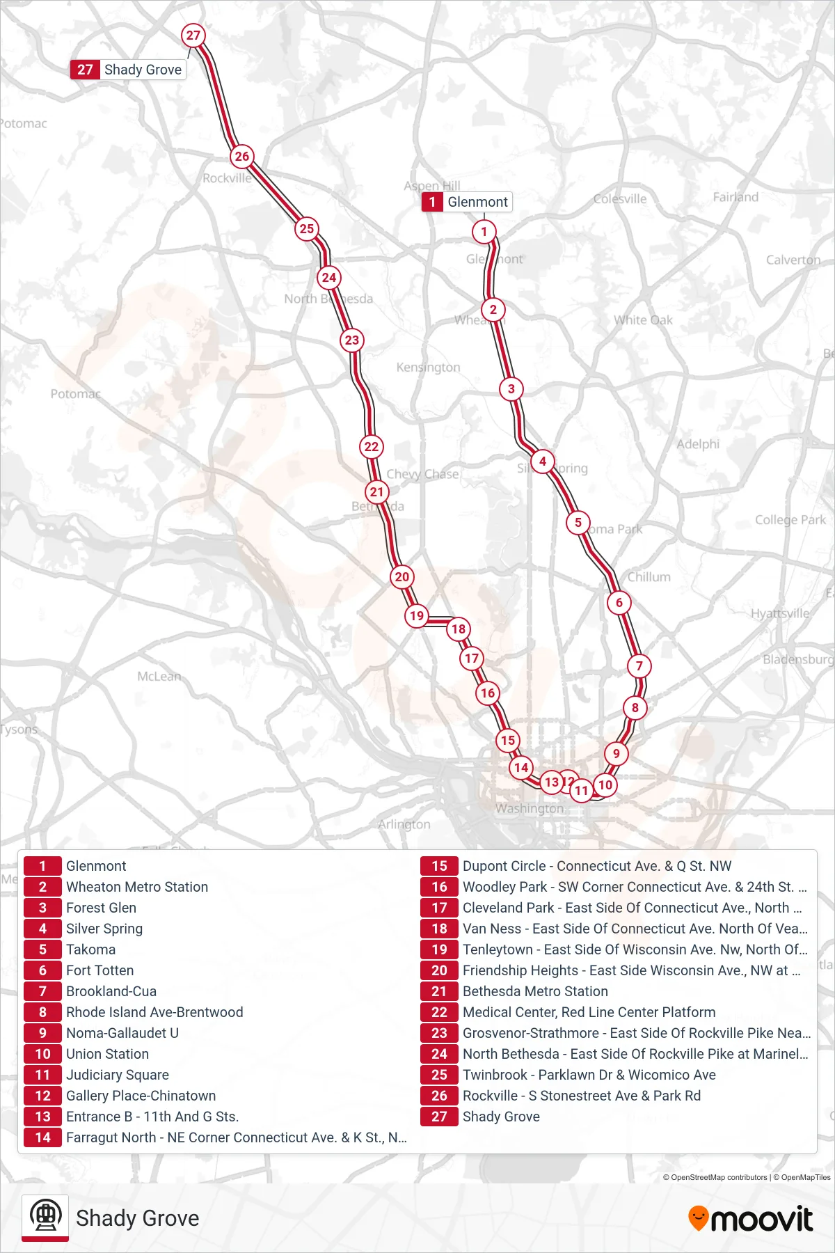
Stops list (RED - Shady Grove)
- Glenmont
- Wheaton Metro Station
- Forest Glen
- Silver Spring
- Takoma
- Fort Totten
- Brookland-Cua
- Rhode Island Ave-Brentwood
- Noma-Gallaudet U
- Union Station
- Judiciary Square
- Gallery Place-Chinatown
- Entrance B - 11th And G Sts.
- Farragut North - NE Corner Connecticut Ave. & K St., NW (Elevator)
- Dupont Circle - Connecticut Ave. & Q St. NW
- Woodley Park - SW Corner Connecticut Ave. & 24th St. NW
- Cleveland Park - East Side Of Connecticut Ave., North Of Ordway St. NW
- Van Ness - East Side Of Connecticut Ave. North Of Veazy St. NW
- Tenleytown - East Side Of Wisconsin Ave. Nw, North Of Albemarle St.
- Friendship Heights - East Side Wisconsin Ave., NW at Western Ave.
- Bethesda Metro Station
- Medical Center, Red Line Center Platform
- Grosvenor-Strathmore - East Side Of Rockville Pike Near Tuckerman Ln.
- North Bethesda - East Side Of Rockville Pike at Marinelli Rd.
- Twinbrook - Parklawn Dr & Wicomico Ave
- Rockville - S Stonestreet Ave & Park Rd
- Shady Grove