
ROUTE D Bus Route Map
View the ROUTE D route map and see all ROUTE D stops along the route. The map of ROUTE D shows where the bus travels and the location of each stop, making it easy to understand the entire route at a glance.
Explore Albany Transit System routes on the map and see where Albany Transit System bus services operate. Use the ROUTE D map to find bus stops and see how the ROUTE D connects different areas along its trip.
All ROUTE D stops on the map are displayed in route order, helping you follow the ROUTE D bus from the first stop to the last.
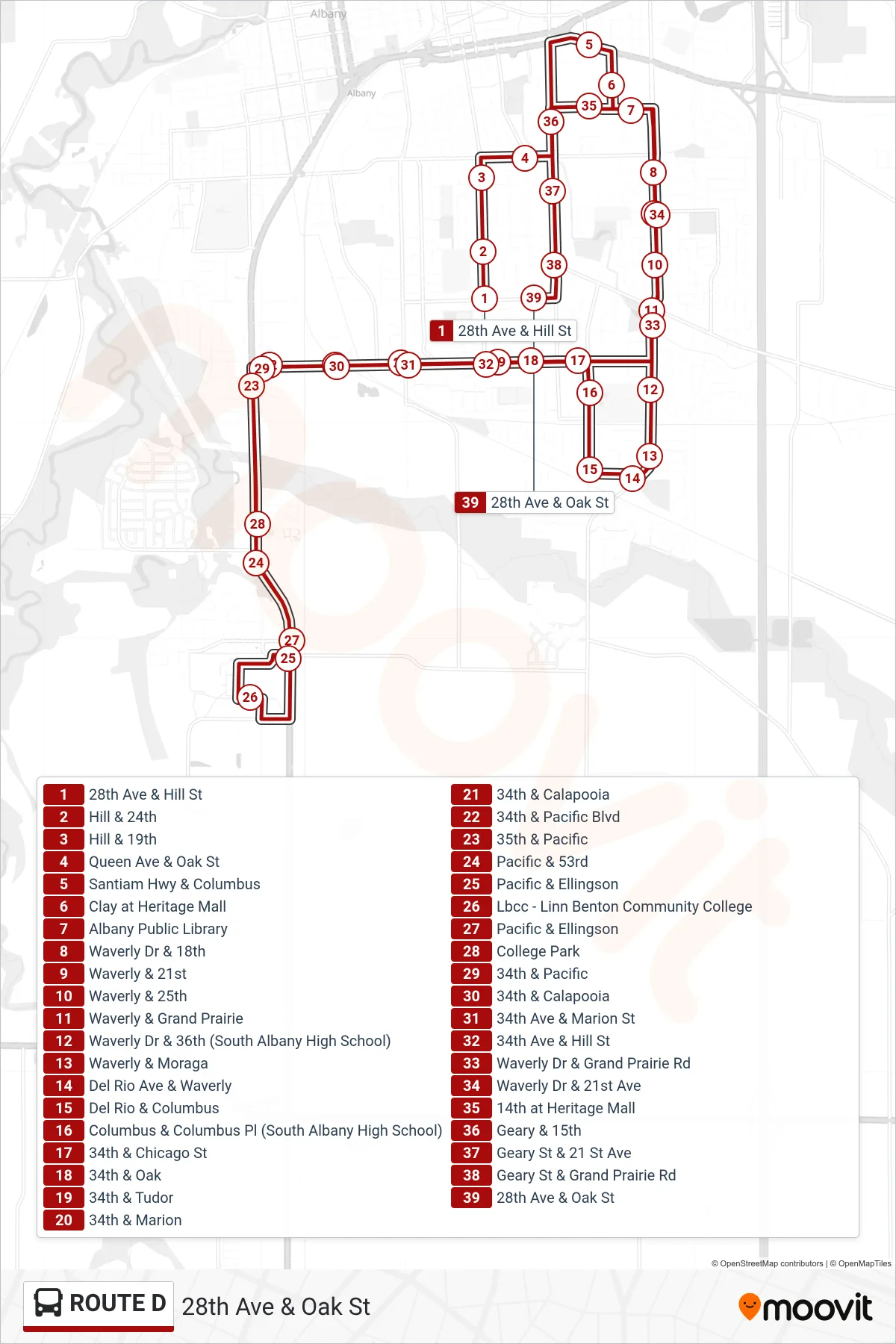
Stops list (ROUTE D - 28th Ave & Oak St)
- 28th Ave & Hill St
- Hill & 24th
- Hill & 19th
- Queen Ave & Oak St
- Santiam Hwy & Columbus
- Clay at Heritage Mall
- Albany Public Library
- Waverly Dr & 18th
- Waverly & 21st
- Waverly & 25th
- Waverly & Grand Prairie
- Waverly Dr & 36th (South Albany High School)
- Waverly & Moraga
- Del Rio Ave & Waverly
- Del Rio & Columbus
- Columbus & Columbus Pl (South Albany High School)
- 34th & Chicago St
- 34th & Oak
- 34th & Tudor
- 34th & Marion
- 34th & Calapooia
- 34th & Pacific Blvd
- 35th & Pacific
- Pacific & 53rd
- Pacific & Ellingson
- Lbcc - Linn Benton Community College
- Pacific & Ellingson
- College Park
- 34th & Pacific
- 34th & Calapooia
- 34th Ave & Marion St
- 34th Ave & Hill St
- Waverly Dr & Grand Prairie Rd
- Waverly Dr & 21st Ave
- 14th at Heritage Mall
- Geary & 15th
- Geary St & 21 St Ave
- Geary St & Grand Prairie Rd
- 28th Ave & Oak St