
S19 Rail Route Map
View the S19 route map and see all S19 stops along the route. The map of S19 shows where the rail travels and the location of each stop, making it easy to understand the entire route at a glance.
Explore S-Bahn routes on the map and see where S-Bahn rail services operate. Use the S19 map to find rail stations and see how the S19 connects different areas along its trip.
All S19 stops on the map are displayed in route order, helping you follow the S19 rail from the first station to the last.
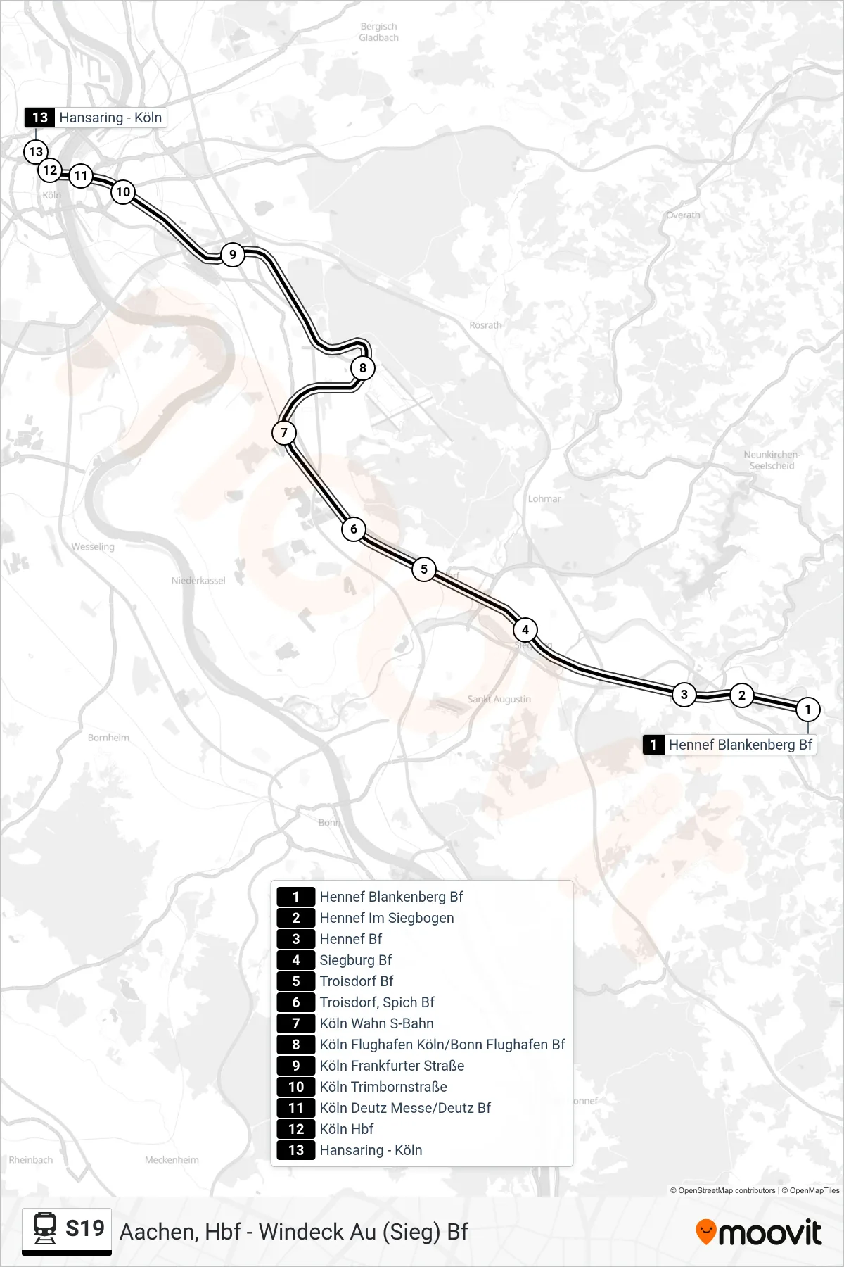
Stops list (S19 - Köln Hansaring)
- Hennef Blankenberg Bf
- Hennef Im Siegbogen
- Hennef Bf
- Siegburg Bf
- Troisdorf Bf
- Troisdorf, Spich Bf
- Köln Wahn S-Bahn
- Köln Flughafen Köln/Bonn Flughafen Bf
- Köln Frankfurter Straße
- Köln Trimbornstraße
- Köln Deutz Messe/Deutz Bf
- Köln Hbf
- Hansaring - Köln
Change direction
- Route Map - S19 - Flughafen Köln/Bonn Bf
- Route Map - S19 - Hennef Bf
- Route Map - S19 - Aachen, Hbf
- Route Map - S19 - Windeck Au (Sieg) Bf
- Route Map - S19 - Köln Messe/Deutz Bf
- Route Map - S19 - Flughafen Köln/Bonn Bf
- Route Map - S19 - Hennef Blankenberg Bf
- Route Map - S19 - Düren, Bf
- Route Map - S19 - Kerpen Sindorf (S)
- Route Map - S19 - Köln Gremberghoven Frankfurter Str.
- Route Map - S19 - Kerpen Horrem Bf
- Route Map - S19 - Troisdorf Bf
- Route Map - S19 - Köln Hbf
- Route Map - S19 - Köln Gremberghoven Frankfurter Str.
- Route Map - S19 - Köln Müngersdorf Technologiepark S-Bahn