
S2 Bus Route Map
View the S2 route map and see all S2 stops along the route. The map of S2 shows where the bus travels and the location of each stop, making it easy to understand the entire route at a glance.
Explore Bus Átha Cliath – Dublin Bus routes on the map and see where Bus Átha Cliath – Dublin Bus bus services operate. Use the S2 map to find bus stops and see how the S2 connects different areas along its trip.
All S2 stops on the map are displayed in route order, helping you follow the S2 bus from the first stop to the last.
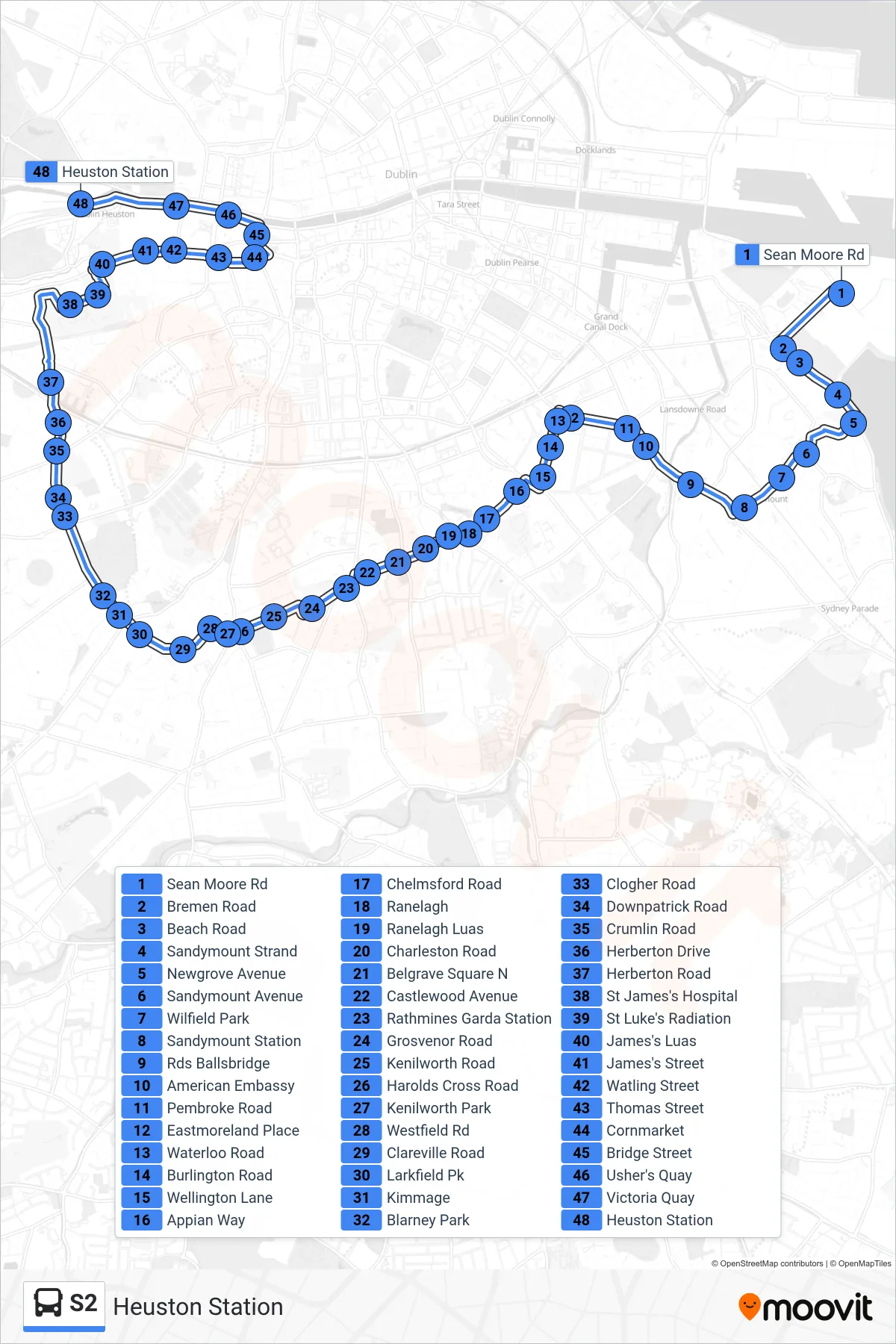
Stops list (S2 - Heuston Station)
- Sean Moore Rd
- Bremen Road
- Beach Road
- Sandymount Strand
- Newgrove Avenue
- Sandymount Avenue
- Wilfield Park
- Sandymount Station
- Rds Ballsbridge
- American Embassy
- Pembroke Road
- Eastmoreland Place
- Waterloo Road
- Burlington Road
- Wellington Lane
- Appian Way
- Chelmsford Road
- Ranelagh
- Ranelagh Luas
- Charleston Road
- Belgrave Square N
- Castlewood Avenue
- Rathmines Garda Station
- Grosvenor Road
- Kenilworth Road
- Harolds Cross Road
- Kenilworth Park
- Westfield Rd
- Clareville Road
- Larkfield Pk
- Kimmage
- Blarney Park
- Clogher Road
- Downpatrick Road
- Crumlin Road
- Herberton Drive
- Herberton Road
- St James's Hospital
- St Luke's Radiation
- James's Luas
- James's Street
- Watling Street
- Thomas Street
- Cornmarket
- Bridge Street
- Usher's Quay
- Victoria Quay
- Heuston Station