
S2 Light Rail Route Map
View the S2 route map and see all S2 stops along the route. The map of S2 shows where the light rail travels and the location of each stop, making it easy to understand the entire route at a glance.
Explore Verkehrsbetriebe Karlsruhe GmbH routes on the map and see where Verkehrsbetriebe Karlsruhe GmbH light rail services operate. Use the S2 map to find light rail stations and see how the S2 connects different areas along its trip.
All S2 stops on the map are displayed in route order, helping you follow the S2 light rail from the first station to the last.
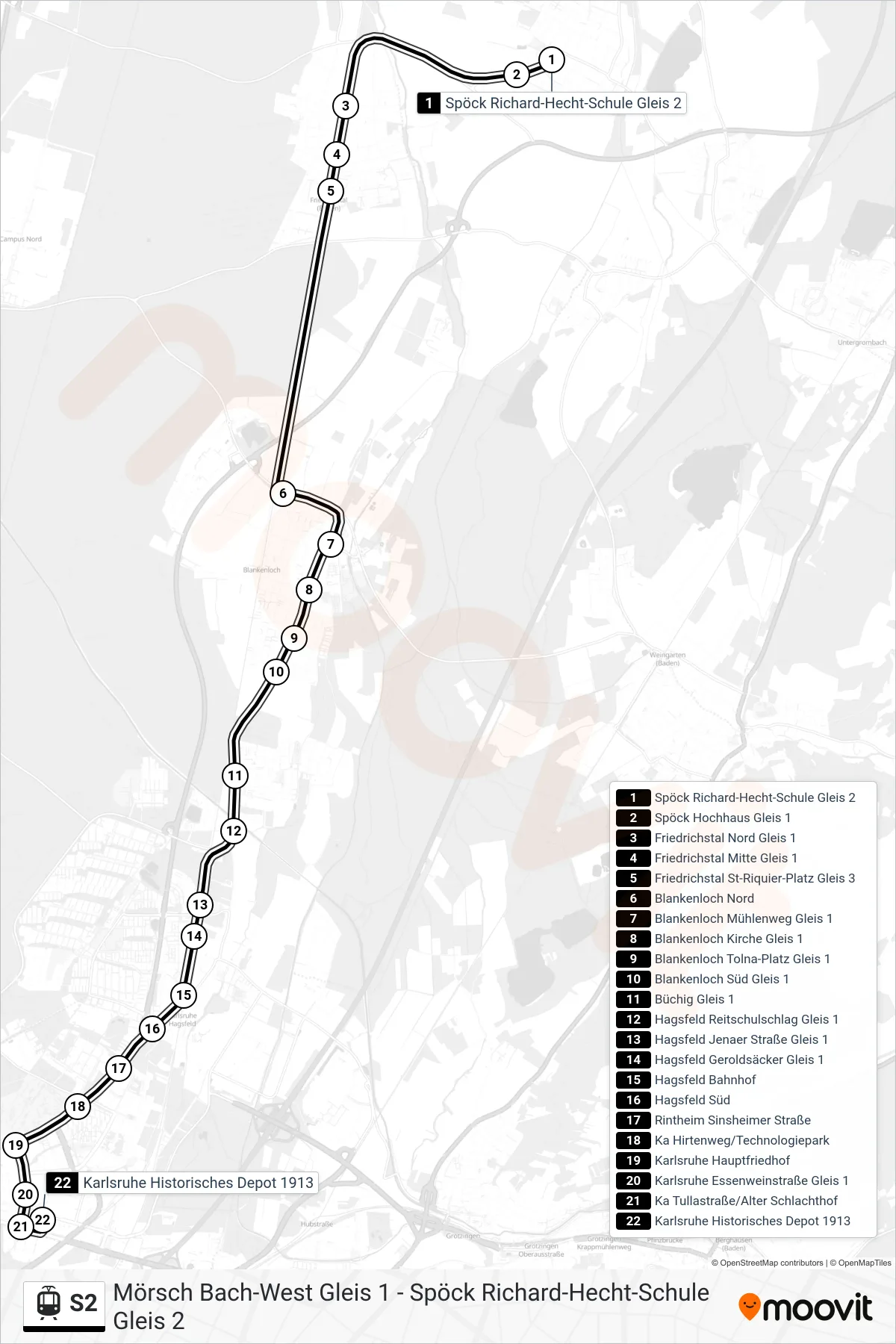
Stops list (S2 - Karlsruhe Historisches Depot 1913)
- Spöck Richard-Hecht-Schule Gleis 2
- Spöck Hochhaus Gleis 1
- Friedrichstal Nord Gleis 1
- Friedrichstal Mitte Gleis 1
- Friedrichstal St-Riquier-Platz Gleis 3
- Blankenloch Nord
- Blankenloch Mühlenweg Gleis 1
- Blankenloch Kirche Gleis 1
- Blankenloch Tolna-Platz Gleis 1
- Blankenloch Süd Gleis 1
- Büchig Gleis 1
- Hagsfeld Reitschulschlag Gleis 1
- Hagsfeld Jenaer Straße Gleis 1
- Hagsfeld Geroldsäcker Gleis 1
- Hagsfeld Bahnhof
- Hagsfeld Süd
- Rintheim Sinsheimer Straße
- Ka Hirtenweg/Technologiepark
- Karlsruhe Hauptfriedhof
- Karlsruhe Essenweinstraße Gleis 1
- Ka Tullastraße/Alter Schlachthof
- Karlsruhe Historisches Depot 1913
Change direction
- Route Map - S2 - Karlsruhe Einfahrt Über Gl. 21
- Route Map - S2 - Blankenloch Nord
- Route Map - S2 - Hagsfeld Reitschulschlag
- Route Map - S2 - Ka Europaplatz
- Route Map - S2 - Karlsruhe Kronenplatz
- Route Map - S2 - Mörsch Bach-West
- Route Map - S2 - Spöck Richard-Hecht-Schule
- Route Map - S2 - Daxlanden Dornröschenweg
- Route Map - S2 - Karlsruhe Rheinhafen