
S33 Bus Route Map
View the S33 route map and see all S33 stops along the route. The map of S33 shows where the bus travels and the location of each stop, making it easy to understand the entire route at a glance.
Explore Arezzo, Siena and Provinces - Tuscan Bus Lines routes on the map and see where Arezzo, Siena and Provinces - Tuscan Bus Lines bus services operate. Use the S33 map to find bus stops and see how the S33 connects different areas along its trip.
All S33 stops on the map are displayed in route order, helping you follow the S33 bus from the first stop to the last.
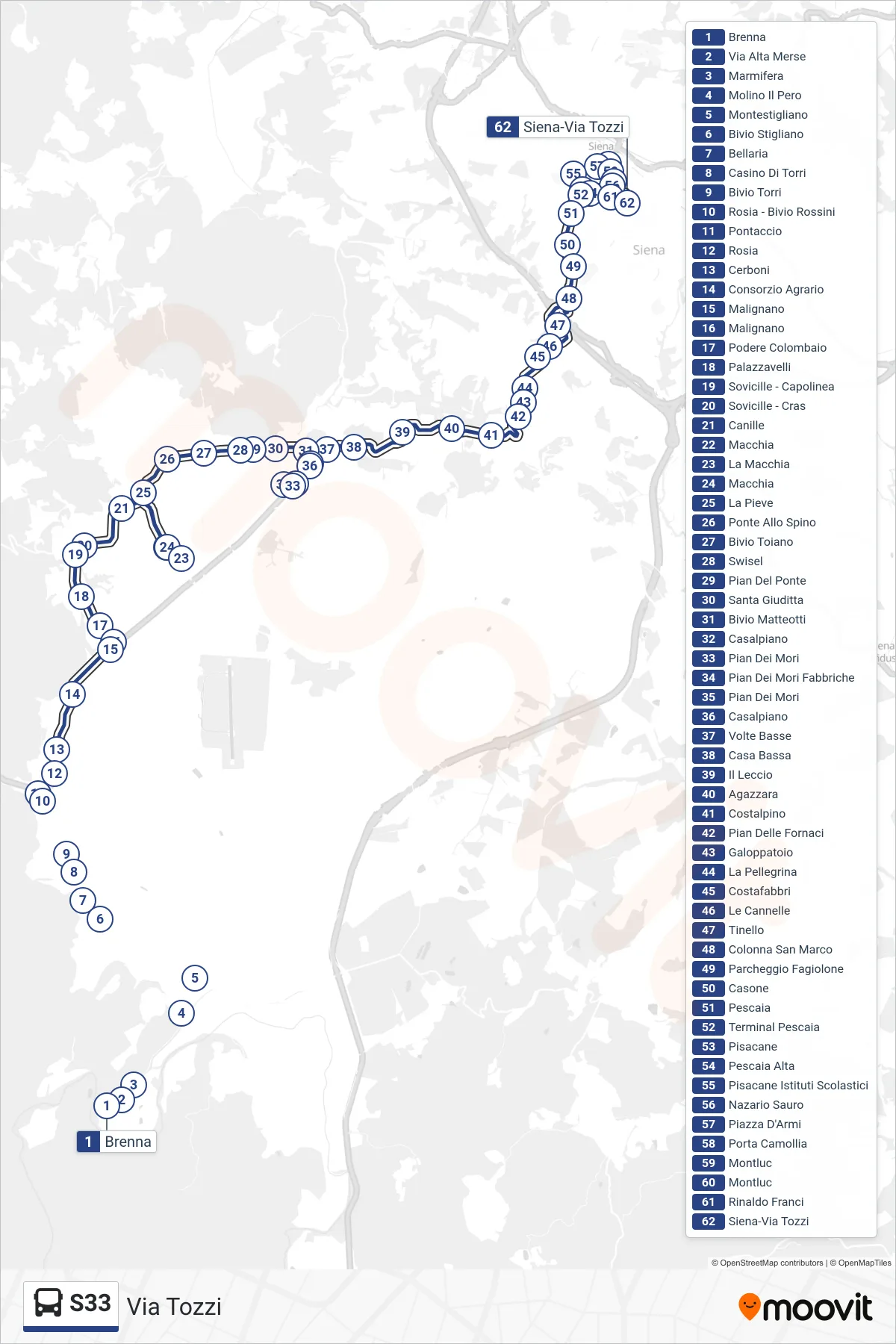
Stops list (S33 - Tozzi Street)
- Brenna
- Via Alta Merse
- Marmifera
- Molino Il Pero
- Montestigliano
- Stigliano Junction
- Bellaria
- Casino Di Torri
- Torri Crossroads
- Rosia - Rossini Junction
- Pontaccio
- Rosia
- Cerboni
- Agricultural Consortium
- Malignano
- Malignano
- Colombaio Estate
- Palazzavelli
- Sovicille - Terminal
- Sovicille - Cras
- Canille
- Macchia
- La Macchia
- Macchia
- The Pieve
- Ponte Allo Spino
- Toiano Junction
- Swisel
- Pian Del Ponte
- Santa Giuditta
- Matteotti Junction
- Casalpiano
- Pian Dei Mori
- Pian Dei Mori Factories
- Pian Dei Mori
- Casalpiano
- Volte Basse
- Bassa House
- Il Leccio
- Agazzara
- Costalpino
- Pian Delle Fornaci
- Riding Track
- La Pellegrina
- Costafabbri
- Le Cannelle
- Tinello
- San Marco Column
- Fagiolone Parking
- Casone
- Pescaia
- Pescaia Terminal
- Pisacane
- Upper Pescaia
- Pisacane School Institutes
- Nazario Sauro
- Arms Square
- Porta Camollia
- Montluc
- Montluc
- Rinaldo Franci
- Siena-Via Tozzi