
S5 Bus Route Map
View the S5 route map and see all S5 stops along the route. The map of S5 shows where the bus travels and the location of each stop, making it easy to understand the entire route at a glance.
Explore Cap Cotentin (Cherbourg, Agglo. du Cotentin) routes on the map and see where Cap Cotentin (Cherbourg, Agglo. du Cotentin) bus services operate. Use the S5 map to find bus stops and see how the S5 connects different areas along its trip.
All S5 stops on the map are displayed in route order, helping you follow the S5 bus from the first stop to the last.
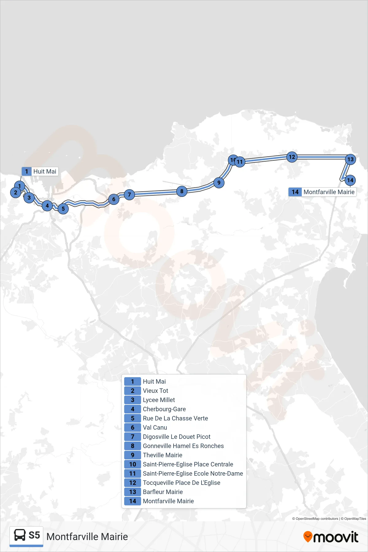
Stops list (S5 - Montfarville Mairie)
- Huit Mai
- Vieux Tot
- Lycee Millet
- Cherbourg-Gare
- Rue De La Chasse Verte
- Val Canu
- Digosville Le Douet Picot
- Gonneville Hamel Es Ronches
- Theville Mairie
- Saint-Pierre-Eglise Place Centrale
- Saint-Pierre-Eglise Ecole Notre-Dame
- Tocqueville Place De L'Eglise
- Barfleur Mairie
- Montfarville Mairie