
SAM SHOPPER SHUTTLE Bus Route Map
View the SAM SHOPPER SHUTTLE route map and see all SAM SHOPPER SHUTTLE stops along the route. The map of SAM SHOPPER SHUTTLE shows where the bus travels and the location of each stop, making it easy to understand the entire route at a glance.
Explore Sandy Area Metro routes on the map and see where Sandy Area Metro bus services operate. Use the SAM SHOPPER SHUTTLE map to find bus stops and see how the SAM SHOPPER SHUTTLE connects different areas along its trip.
All SAM SHOPPER SHUTTLE stops on the map are displayed in route order, helping you follow the SAM SHOPPER SHUTTLE bus from the first stop to the last.
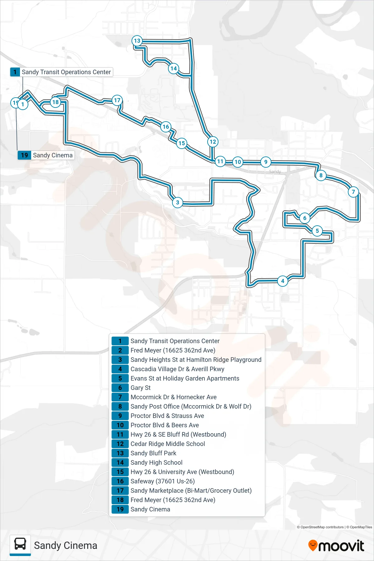
Stops list (SAM SHOPPER SHUTTLE - Sandy Cinema)
- Sandy Transit Operations Center
- Fred Meyer (16625 362nd Ave)
- Sandy Heights St at Hamilton Ridge Playground
- Cascadia Village Dr & Averill Pkwy
- Evans St at Holiday Garden Apartments
- Gary St
- Mccormick Dr & Hornecker Ave
- Sandy Post Office (Mccormick Dr & Wolf Dr)
- Proctor Blvd & Strauss Ave
- Proctor Blvd & Beers Ave
- Hwy 26 & SE Bluff Rd (Westbound)
- Cedar Ridge Middle School
- Sandy Bluff Park
- Sandy High School
- Hwy 26 & University Ave (Westbound)
- Safeway (37601 Us-26)
- Sandy Marketplace (Bi-Mart/Grocery Outlet)
- Fred Meyer (16625 362nd Ave)
- Sandy Cinema