
SAVIT Bus Route Map
View the SAVIT route map and see all SAVIT stops along the route. The map of SAVIT shows where the bus travels and the location of each stop, making it easy to understand the entire route at a glance.
Explore SAVIT routes on the map and see where SAVIT bus services operate. Use the SAVIT map to find bus stops and see how the SAVIT connects different areas along its trip.
All SAVIT stops on the map are displayed in route order, helping you follow the SAVIT bus from the first stop to the last.
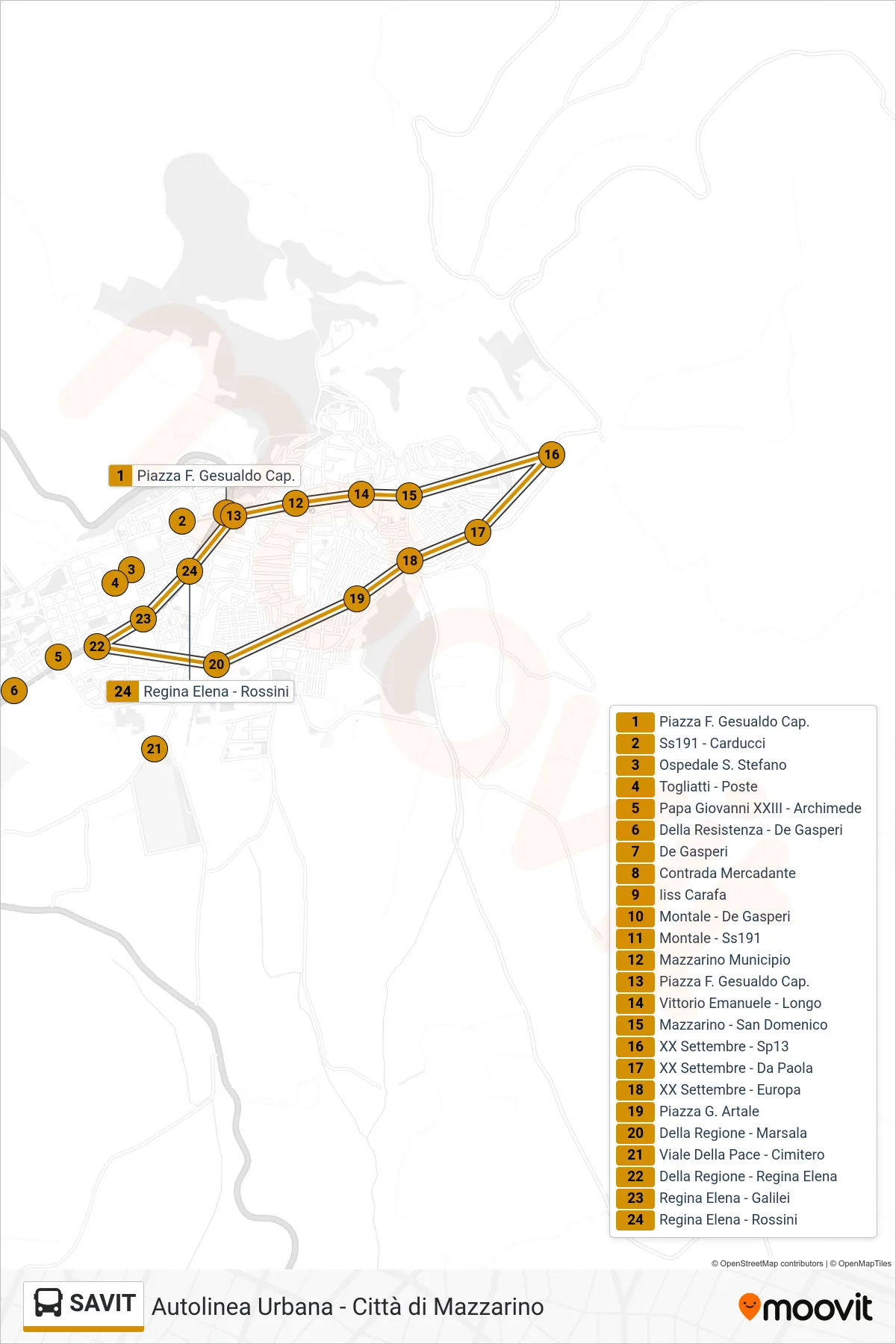
Stops list (SAVIT - Gesualdo Square)
- Captain F. Gesualdo Square
- SS191 - Carducci
- St. Stefano Hospital
- Togliatti - Post Office
- Pope John XXIII - Archimedes
- Della Resistenza - De Gasperi
- De Gasperi
- Mercadante District
- Carafa High School
- Montale - De Gasperi
- Montale - State Road 191
- Mazzarino City Hall
- Captain F. Gesualdo Square
- Vittorio Emanuele - Longo
- Mazzarino - San Domenico
- September 20th - Sp13
- XX September - Da Paola
- XX September - Europa
- Piazza G. Artale
- Della Regione - Marsala
- Peace Avenue - Cemetery
- Della Regione - Regina Elena
- Regina Elena - Galilei
- Regina Elena - Rossini