
SB36 Bus Route Map
View the SB36 route map and see all SB36 stops along the route. The map of SB36 shows where the bus travels and the location of each stop, making it easy to understand the entire route at a glance.
Explore Vestische routes on the map and see where Vestische bus services operate. Use the SB36 map to find bus stops and see how the SB36 connects different areas along its trip.
All SB36 stops on the map are displayed in route order, helping you follow the SB36 bus from the first stop to the last.
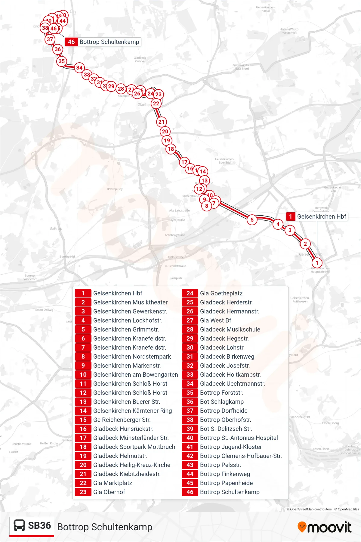
Stops list (SB36 - Bottrop Schultenkamp)
- Gelsenkirchen Hbf
- Gelsenkirchen Musiktheater
- Gelsenkirchen Gewerkenstr.
- Gelsenkirchen Lockhofstr.
- Gelsenkirchen Grimmstr.
- Gelsenkirchen Kranefeldstr.
- Gelsenkirchen Kranefeldstr.
- Gelsenkirchen Nordsternpark
- Gelsenkirchen Markenstr.
- Gelsenkirchen am Bowengarten
- Gelsenkirchen Schloß Horst
- Gelsenkirchen Schloß Horst
- Gelsenkirchen Buerer Str.
- Gelsenkirchen Kärntener Ring
- Ge Reichenberger Str.
- Gladbeck Hunsrückstr.
- Gladbeck Münsterländer Str.
- Gladbeck Sportpark Mottbruch
- Gladbeck Helmutstr.
- Gladbeck Heilig-Kreuz-Kirche
- Gladbeck Kiebitzheidestr.
- Gla Marktplatz
- Gla Oberhof
- Gla Goetheplatz
- Gladbeck Herderstr.
- Gladbeck Hermannstr.
- Gla West Bf
- Gladbeck Musikschule
- Gladbeck Hegestr.
- Gladbeck Lohstr.
- Gladbeck Birkenweg
- Gladbeck Josefstr.
- Gladbeck Holtkampstr.
- Gladbeck Uechtmannstr.
- Bottrop Forststr.
- Bot Schlagkamp
- Bottrop Dorfheide
- Bottrop Oberhofstr.
- Bot S.-Delitzsch-Str.
- Bottrop St.-Antonius-Hospital
- Bottrop Jugend-Kloster
- Bottrop Clemens-Hofbauer-Str.
- Bottrop Pelsstr.
- Bottrop Finkenweg
- Bottrop Papenheide
- Bottrop Schultenkamp