
SB58 Bus Route Map
View the SB58 route map and see all SB58 stops along the route. The map of SB58 shows where the bus travels and the location of each stop, making it easy to understand the entire route at a glance.
Explore Niederrheinische VKB routes on the map and see where Niederrheinische VKB bus services operate. Use the SB58 map to find bus stops and see how the SB58 connects different areas along its trip.
All SB58 stops on the map are displayed in route order, helping you follow the SB58 bus from the first stop to the last.
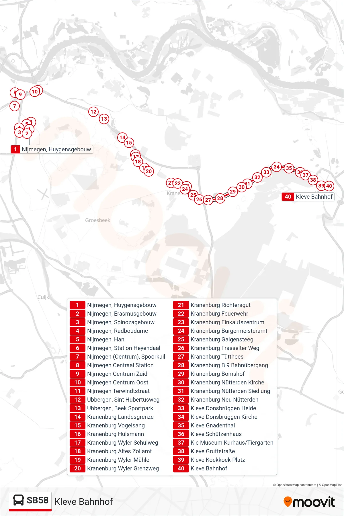
Stops list (SB58 - Kleve Bahnhof)
- Nijmegen, Huygensgebouw
- Nijmegen, Erasmusgebouw
- Nijmegen, Spinozagebouw
- Nijmegen, Radboudumc
- Nijmegen, Han
- Nijmegen, Station Heyendaal
- Nijmegen (Centrum), Spoorkuil
- Nijmegen Centraal Station
- Nijmegen Centrum Zuid
- Nijmegen Centrum Oost
- Nijmegen Terwindtstraat
- Ubbergen, Sint Hubertusweg
- Ubbergen, Beek Sportpark
- Kranenburg Landesgrenze
- Kranenburg Vogelsang
- Kranenburg Hülsmann
- Kranenburg Wyler Schulweg
- Kranenburg Altes Zollamt
- Kranenburg Wyler Mühle
- Kranenburg Wyler Grenzweg
- Kranenburg Richtersgut
- Kranenburg Feuerwehr
- Kranenburg Einkaufszentrum
- Kranenburg Bürgermeisteramt
- Kranenburg Galgensteeg
- Kranenburg Frasselter Weg
- Kranenburg Tütthees
- Kranenburg B 9 Bahnübergang
- Kranenburg Bomshof
- Kranenburg Nütterden Kirche
- Kranenburg Nütterden Siedlung
- Kranenburg Neu Nütterden
- Kleve Donsbrüggen Heide
- Kleve Donsbrüggen Kirche
- Kleve Gnadenthal
- Kleve Schützenhaus
- Kle Museum Kurhaus/Tiergarten
- Kleve Gruftstraße
- Kleve Koekkoek-Platz
- Kleve Bahnhof