
SIM2 Bus Route Map
View the SIM2 route map and see all SIM2 stops along the route. The map of SIM2 shows where the bus travels and the location of each stop, making it easy to understand the entire route at a glance.
Explore MTA New York City Transit - Express routes routes on the map and see where MTA New York City Transit - Express routes bus services operate. Use the SIM2 map to find bus stops and see how the SIM2 connects different areas along its trip.
All SIM2 stops on the map are displayed in route order, helping you follow the SIM2 bus from the first stop to the last.
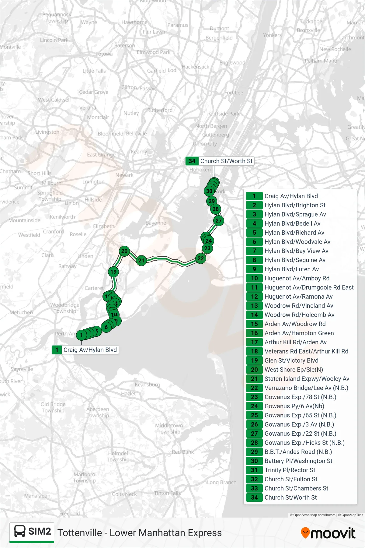
Stops list (SIM2 - Downtown Worth St Via Church St)
- Craig Av/Hylan Blvd
- Hylan Blvd/Brighton St
- Hylan Blvd/Sprague Av
- Hylan Blvd/Bedell Av
- Hylan Blvd/Richard Av
- Hylan Blvd/Woodvale Av
- Hylan Blvd/Bay View Av
- Hylan Blvd/Seguine Av
- Hylan Blvd/Luten Av
- Huguenot Av/Amboy Rd
- Huguenot Av/Drumgoole Rd East
- Huguenot Av/Ramona Av
- Woodrow Rd/Vineland Av
- Woodrow Rd/Holcomb Av
- Arden Av/Woodrow Rd
- Arden Av/Hampton Green
- Arthur Kill Rd/Arden Av
- Veterans Rd East/Arthur Kill Rd
- Glen St/Victory Blvd
- West Shore Ep/Sie(N)
- Staten Island Expwy/Wooley Av
- Verrazano Bridge/Lee Av (N.B.)
- Gowanus Exp./78 St (N.B.)
- Gowanus Py/6 Av(Nb)
- Gowanus Exp./65 St (N.B.)
- Gowanus Exp./3 Av (N.B.)
- Gowanus Exp./22 St (N.B.)
- Gowanus Exp./Hicks St (N.B.)
- B.B.T./Andes Road (N.B.)
- Battery Pl/Washington St
- Trinity Pl/Rector St
- Church St/Fulton St
- Church St/Chambers St
- Church St/Worth St