
SIM35 Bus Route Map
View the SIM35 route map and see all SIM35 stops along the route. The map of SIM35 shows where the bus travels and the location of each stop, making it easy to understand the entire route at a glance.
Explore MTA New York City Transit - Express routes routes on the map and see where MTA New York City Transit - Express routes bus services operate. Use the SIM35 map to find bus stops and see how the SIM35 connects different areas along its trip.
All SIM35 stops on the map are displayed in route order, helping you follow the SIM35 bus from the first stop to the last.
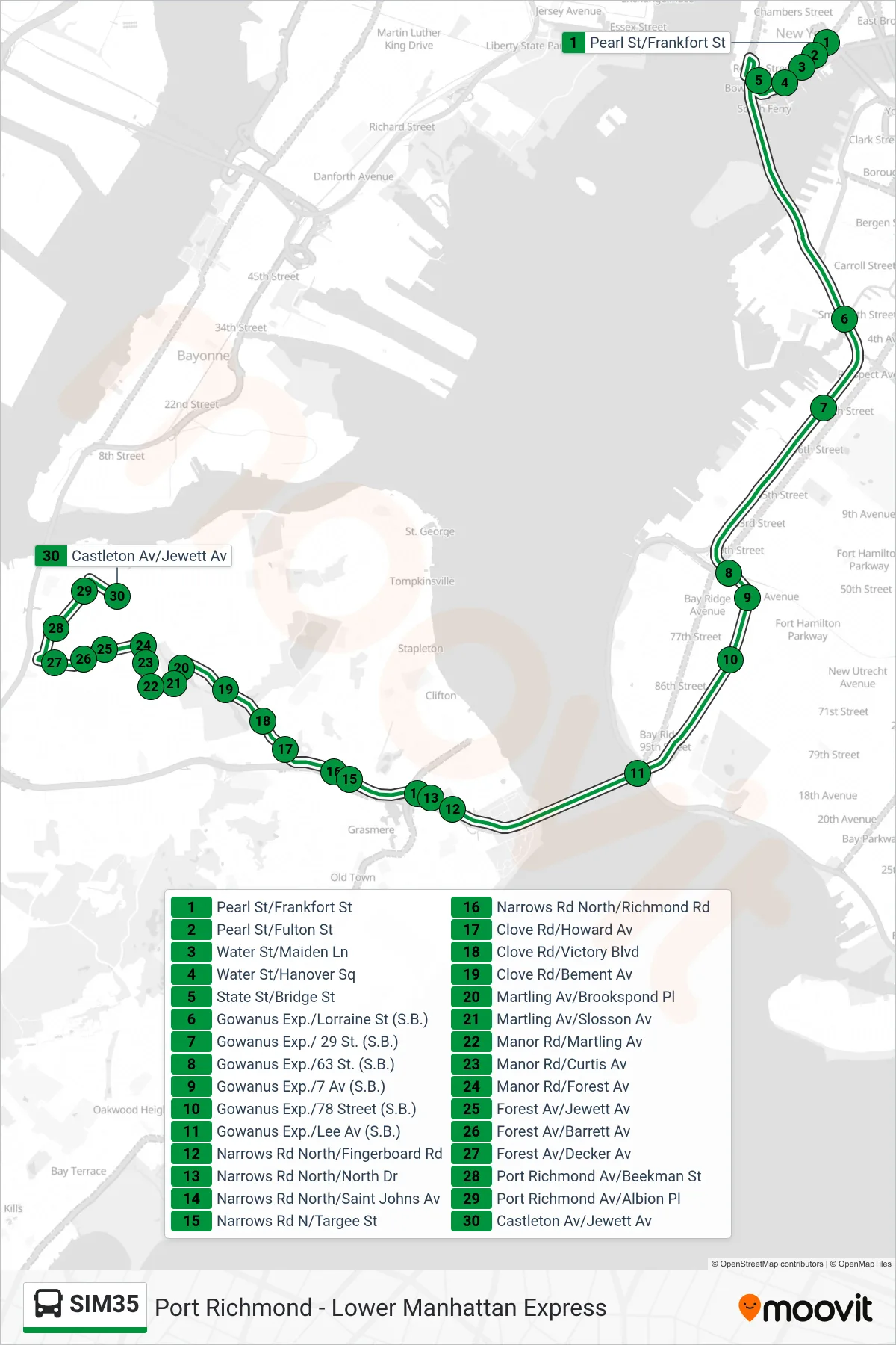
Stops list (SIM35 - Port Richmond Via Clove Rd)
- Pearl St/Frankfort St
- Pearl St/Fulton St
- Water St/Maiden Ln
- Water St/Hanover Sq
- State St/Bridge St
- Gowanus Exp./Lorraine St (S.B.)
- Gowanus Exp./ 29 St. (S.B.)
- Gowanus Exp./63 St. (S.B.)
- Gowanus Exp./7 Av (S.B.)
- Gowanus Exp./78 Street (S.B.)
- Gowanus Exp./Lee Av (S.B.)
- Narrows Rd North/Fingerboard Rd
- Narrows Rd North/North Dr
- Narrows Rd North/Saint Johns Av
- Narrows Rd N/Targee St
- Narrows Rd North/Richmond Rd
- Clove Rd/Howard Av
- Clove Rd/Victory Blvd
- Clove Rd/Bement Av
- Martling Av/Brookspond Pl
- Martling Av/Slosson Av
- Manor Rd/Martling Av
- Manor Rd/Curtis Av
- Manor Rd/Forest Av
- Forest Av/Jewett Av
- Forest Av/Barrett Av
- Forest Av/Decker Av
- Port Richmond Av/Beekman St
- Port Richmond Av/Albion Pl
- Castleton Av/Jewett Av