
SKIP Bus Route Map
View the SKIP route map and see all SKIP stops along the route. The map of SKIP shows where the bus travels and the location of each stop, making it easy to understand the entire route at a glance.
Explore Regional Transportation District routes on the map and see where Regional Transportation District bus services operate. Use the SKIP map to find bus stops and see how the SKIP connects different areas along its trip.
All SKIP stops on the map are displayed in route order, helping you follow the SKIP bus from the first stop to the last.
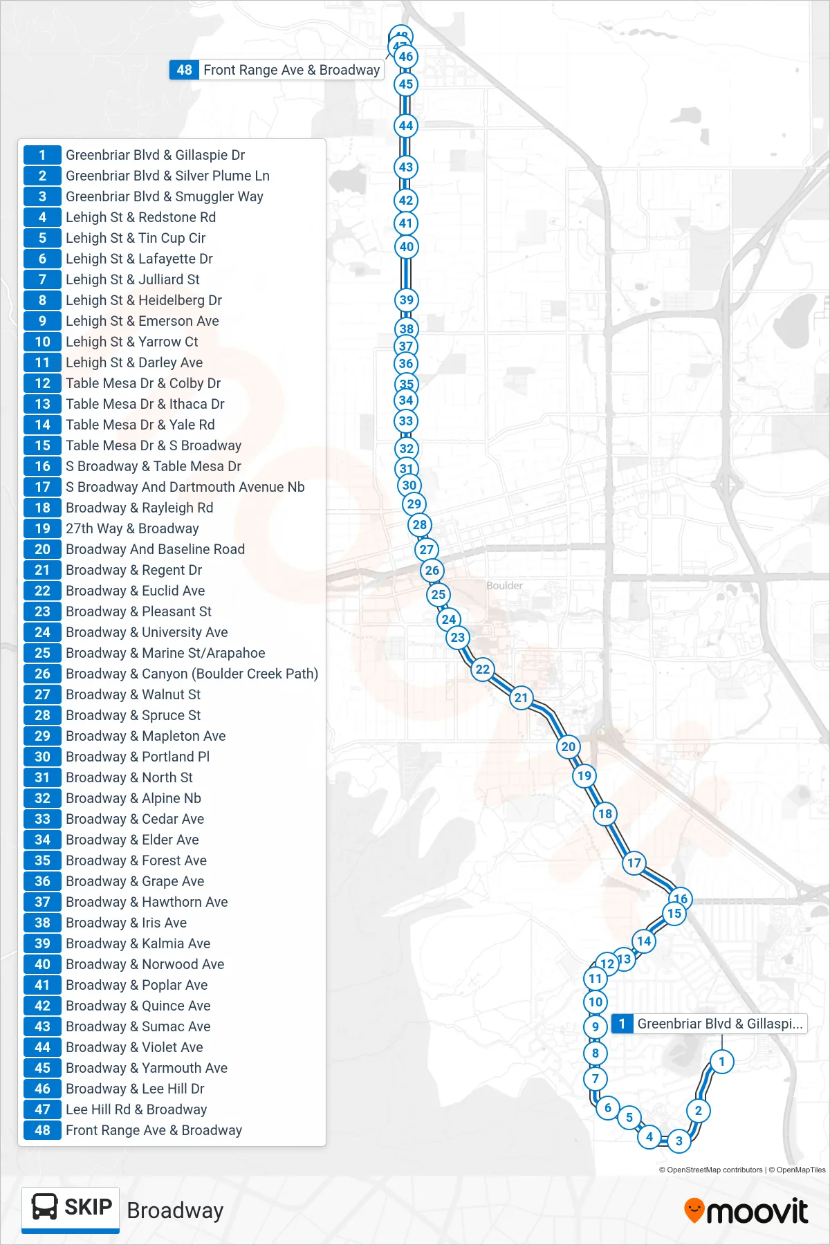
Stops list (SKIP - Front Range/Broadway)
- Greenbriar Blvd & Gillaspie Dr
- Greenbriar Blvd & Silver Plume Ln
- Greenbriar Blvd & Smuggler Way
- Lehigh St & Redstone Rd
- Lehigh St & Tin Cup Cir
- Lehigh St & Lafayette Dr
- Lehigh St & Julliard St
- Lehigh St & Heidelberg Dr
- Lehigh St & Emerson Ave
- Lehigh St & Yarrow Ct
- Lehigh St & Darley Ave
- Table Mesa Dr & Colby Dr
- Table Mesa Dr & Ithaca Dr
- Table Mesa Dr & Yale Rd
- Table Mesa Dr & S Broadway
- S Broadway & Table Mesa Dr
- S Broadway And Dartmouth Avenue Nb
- Broadway & Rayleigh Rd
- 27th Way & Broadway
- Broadway And Baseline Road
- Broadway & Regent Dr
- Broadway & Euclid Ave
- Broadway & Pleasant St
- Broadway & University Ave
- Broadway & Marine St/Arapahoe
- Broadway & Canyon (Boulder Creek Path)
- Broadway & Walnut St
- Broadway & Spruce St
- Broadway & Mapleton Ave
- Broadway & Portland Pl
- Broadway & North St
- Broadway & Alpine Nb
- Broadway & Cedar Ave
- Broadway & Elder Ave
- Broadway & Forest Ave
- Broadway & Grape Ave
- Broadway & Hawthorn Ave
- Broadway & Iris Ave
- Broadway & Kalmia Ave
- Broadway & Norwood Ave
- Broadway & Poplar Ave
- Broadway & Quince Ave
- Broadway & Sumac Ave
- Broadway & Violet Ave
- Broadway & Yarmouth Ave
- Broadway & Lee Hill Dr
- Lee Hill Rd & Broadway
- Front Range Ave & Broadway