
SP Bus Route Map
View the SP route map and see all SP stops along the route. The map of SP shows where the bus travels and the location of each stop, making it easy to understand the entire route at a glance.
Explore ATMA S.c.p.a. routes on the map and see where ATMA S.c.p.a. bus services operate. Use the SP map to find bus stops and see how the SP connects different areas along its trip.
All SP stops on the map are displayed in route order, helping you follow the SP bus from the first stop to the last.
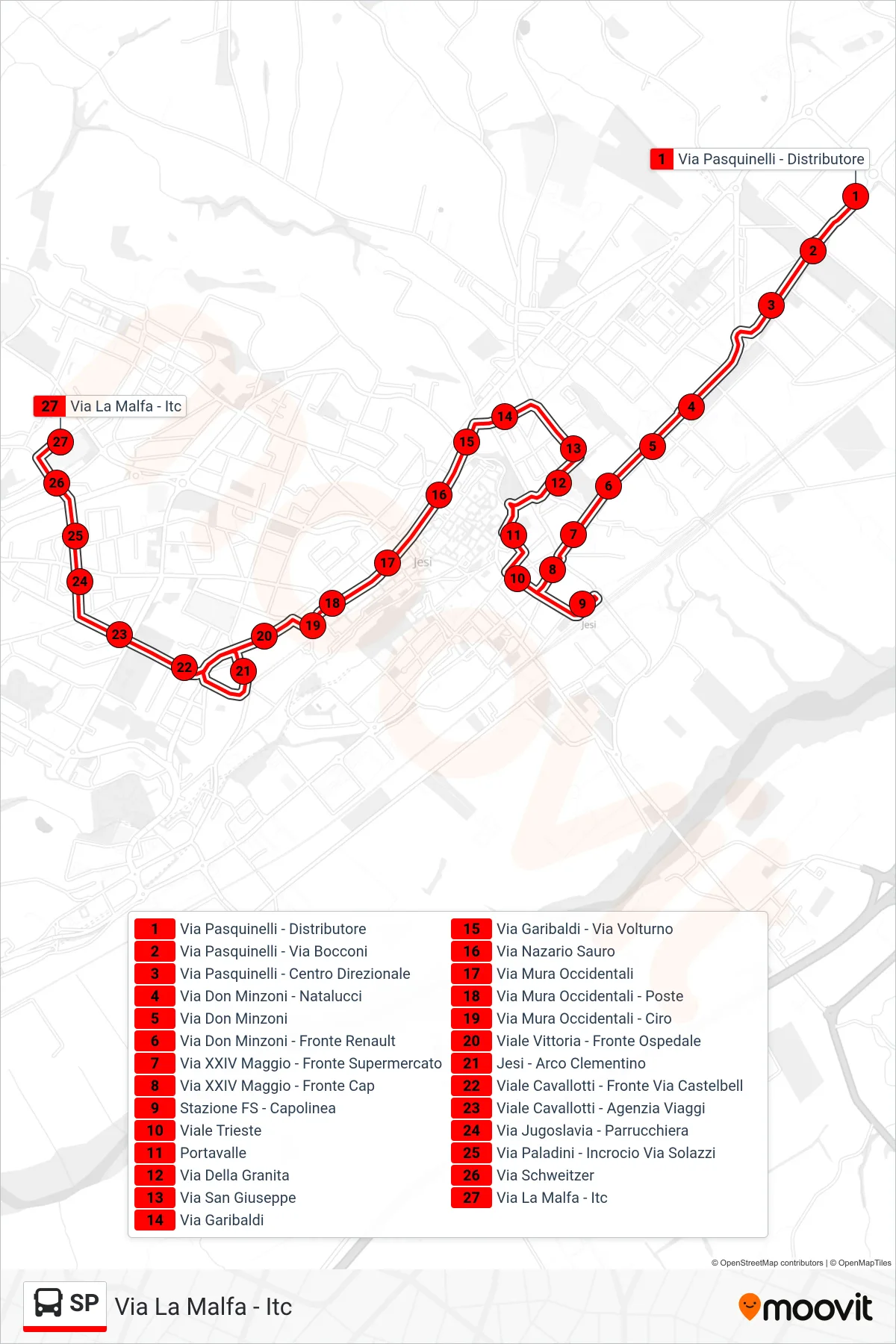
Stops list (SP - Via La Malfa - ITC)
- Via Pasquinelli - Gas Station
- Pasquinelli Street - Bocconi Street
- Pasquinelli Street - Business Center
- Don Minzoni Street - Natalucci
- Don Minzoni Street
- Don Minzoni Street - Opposite Renault
- 24th May Street - Opposite Supermarket
- 24th May Street - Opposite Cap
- Railway Station - Terminal
- Trieste Avenue
- Portavalle
- Via Della Granita
- San Giuseppe Street
- Garibaldi Street
- Garibaldi Street - Volturno Street
- Nazario Sauro Street
- Western Walls Street
- Western Walls Street - Post Office
- Western Walls Street - Ciro
- Victory Avenue - Opposite Hospital
- Jesi - Clementine Arch
- Viale Cavallotti - Opposite Via Castelbellino
- Cavallotti Avenue - Travel Agency
- Yugoslavia Street - Hairdresser
- Paladini Street - Solazzi Street Junction
- Schweitzer Street
- Via La Malfa - ITC
Change direction
- Route Map - SP - Jesi (Bus Station)
- Route Map - SP - Railway Station - Terminal
- Route Map - SP - Jesi - Clementine Arch
- Route Map - SP - Viale Verdi - High School
- Route Map - SP - Viale Del Lavoro - Gas Station
- Route Map - SP - Portavalle
- Route Map - SP - Portavalle
- Route Map - SP - Via Gola Della Rossa
- Route Map - SP - Via Gola Della Rossa