
SURFSIDE BEACH ROUTE Bus Route Map
View the SURFSIDE BEACH ROUTE route map and see all SURFSIDE BEACH ROUTE stops along the route. The map of SURFSIDE BEACH ROUTE shows where the bus travels and the location of each stop, making it easy to understand the entire route at a glance.
Explore Nantucket Regional Transit Authority routes on the map and see where Nantucket Regional Transit Authority bus services operate. Use the SURFSIDE BEACH ROUTE map to find bus stops and see how the SURFSIDE BEACH ROUTE connects different areas along its trip.
All SURFSIDE BEACH ROUTE stops on the map are displayed in route order, helping you follow the SURFSIDE BEACH ROUTE bus from the first stop to the last.
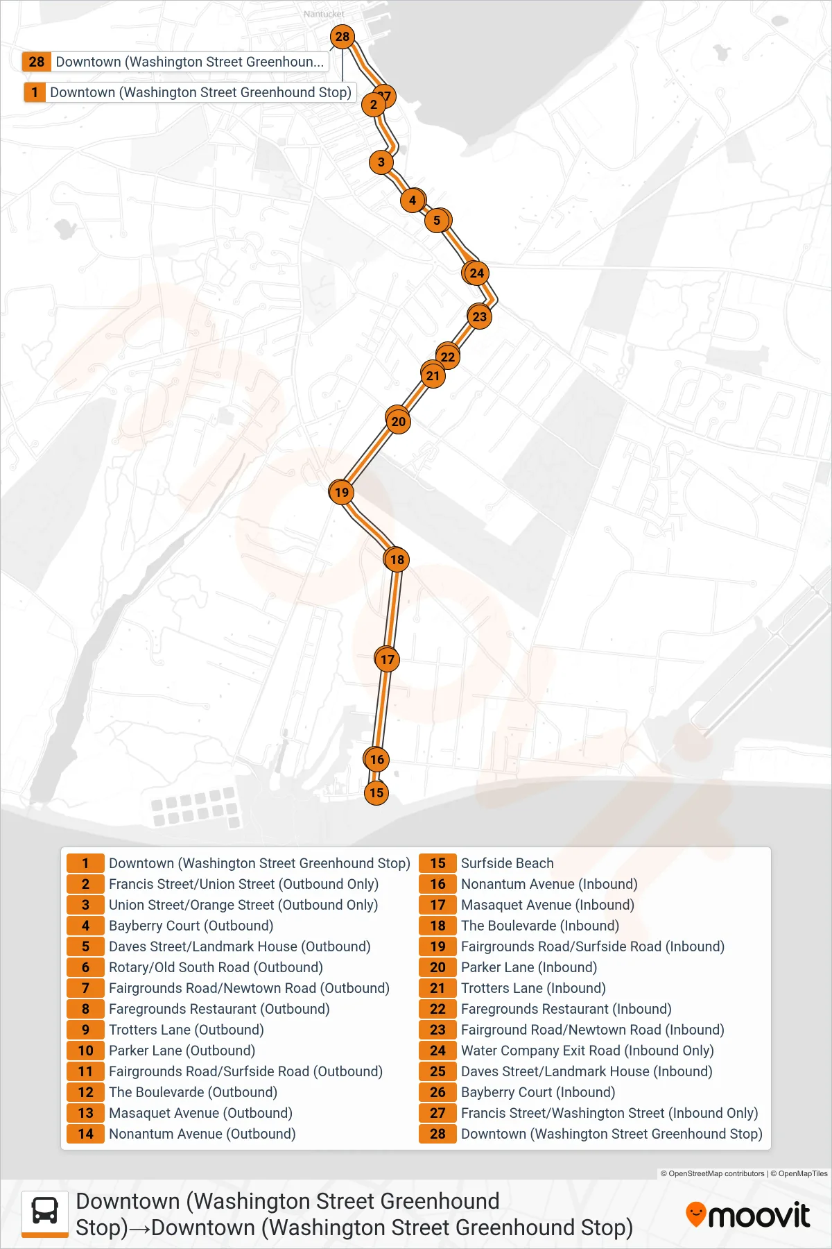
Stops list (SURFSIDE BEACH ROUTE - Downtown (Washington Street Greenhound Stop)→Downtown (Washington Street Greenhound Stop))
- Downtown (Washington Street Greenhound Stop)
- Francis Street/Union Street (Outbound Only)
- Union Street/Orange Street (Outbound Only)
- Bayberry Court (Outbound)
- Daves Street/Landmark House (Outbound)
- Rotary/Old South Road (Outbound)
- Fairgrounds Road/Newtown Road (Outbound)
- Faregrounds Restaurant (Outbound)
- Trotters Lane (Outbound)
- Parker Lane (Outbound)
- Fairgrounds Road/Surfside Road (Outbound)
- The Boulevarde (Outbound)
- Masaquet Avenue (Outbound)
- Nonantum Avenue (Outbound)
- Surfside Beach
- Nonantum Avenue (Inbound)
- Masaquet Avenue (Inbound)
- The Boulevarde (Inbound)
- Fairgrounds Road/Surfside Road (Inbound)
- Parker Lane (Inbound)
- Trotters Lane (Inbound)
- Faregrounds Restaurant (Inbound)
- Fairground Road/Newtown Road (Inbound)
- Water Company Exit Road (Inbound Only)
- Daves Street/Landmark House (Inbound)
- Bayberry Court (Inbound)
- Francis Street/Washington Street (Inbound Only)
- Downtown (Washington Street Greenhound Stop)