
T Bus Route Map
View the T route map and see all T stops along the route. The map of T shows where the bus travels and the location of each stop, making it easy to understand the entire route at a glance.
Explore Chapel Hill Transit routes on the map and see where Chapel Hill Transit bus services operate. Use the T map to find bus stops and see how the T connects different areas along its trip.
All T stops on the map are displayed in route order, helping you follow the T bus from the first stop to the last.
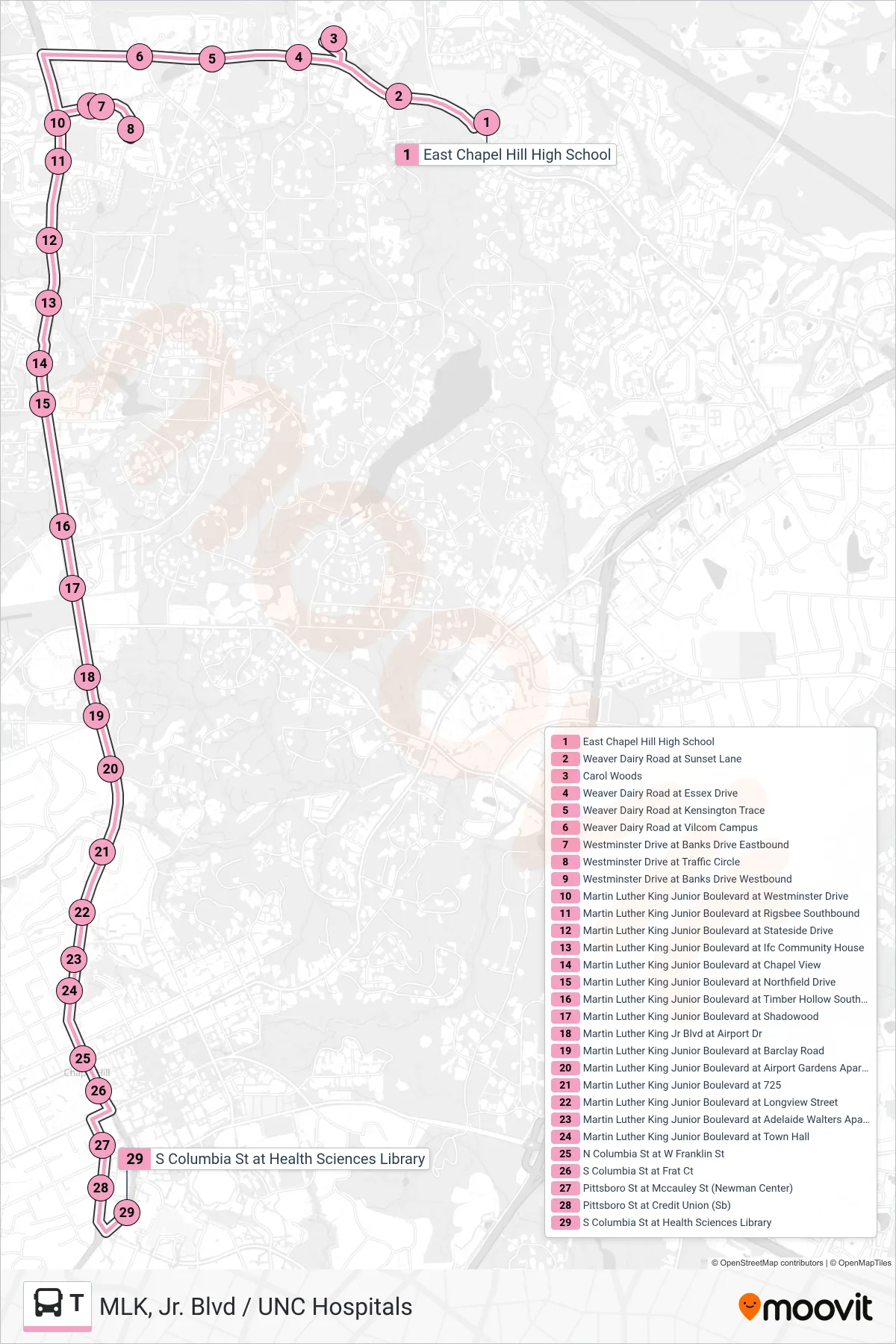
Stops list (T - East Chapel Hill High School→South Columbia Street at Health Sciences Library)
- East Chapel Hill High School
- Weaver Dairy Road at Sunset Lane
- Carol Woods
- Weaver Dairy Road at Essex Drive
- Weaver Dairy Road at Kensington Trace
- Weaver Dairy Road at Vilcom Campus
- Westminster Drive at Banks Drive Eastbound
- Westminster Drive at Traffic Circle
- Westminster Drive at Banks Drive Westbound
- Martin Luther King Junior Boulevard at Westminster Drive
- Martin Luther King Junior Boulevard at Rigsbee Southbound
- Martin Luther King Junior Boulevard at Stateside Drive
- Martin Luther King Junior Boulevard at Ifc Community House
- Martin Luther King Junior Boulevard at Chapel View
- Martin Luther King Junior Boulevard at Northfield Drive
- Martin Luther King Junior Boulevard at Timber Hollow Southbound
- Martin Luther King Junior Boulevard at Shadowood
- Martin Luther King Jr Blvd at Airport Dr
- Martin Luther King Junior Boulevard at Barclay Road
- Martin Luther King Junior Boulevard at Airport Gardens Apartments
- Martin Luther King Junior Boulevard at 725
- Martin Luther King Junior Boulevard at Longview Street
- Martin Luther King Junior Boulevard at Adelaide Walters Apartments
- Martin Luther King Junior Boulevard at Town Hall
- N Columbia St at W Franklin St
- S Columbia St at Frat Ct
- Pittsboro St at Mccauley St (Newman Center)
- Pittsboro St at Credit Union (Sb)
- S Columbia St at Health Sciences Library